
Keystoned Steel // Field Guide
Humber River
The brief
class="v-brief">What this guide covers: the lake-run water of the Humber River in Fisheries Management Zone 16 (FMZ 16), under the Toronto and Region Conservation Authority (TRCA) — Toronto's urban heritage river, a designated Canadian Heritage River whose lower valley runs through city parkland from Humber Bay on Lake Ontario to Eglinton Avenue and beyond. The lower river below Eglinton is open all year, the water above it carries an extended fall season to Highway 407, and the best-placed gauge in the west set — Weston, inside the lake-run corridor itself — tells you what the fish are feeling. Two live Water Survey of Canada gauges watch this river, and this guide uses both.
01 — Section
1. The idea in one paragraph
The Humber should not work, and it does. This is a river that drains the largest city in Canada, runs past subway stations and subdivisions, and still pulls Chinook salmon over the Old Mill weir every fall in front of crowds on a city park bank, still sends steelhead through a fish ladder at Raymore Park, and still fishes like a river instead of a storm drain. The secret is the valley: after the flood that remade Toronto in 1954, the Humber's floodplain became parkland, so the lower river runs through a connected ribbon of city parks — Étienne Brûlé, Magwood, Raymore, Smythe — and park access is the access, legal and public in a way most tributaries never manage.
Above Eglinton the season extends to December 31 as far as Highway 407; below Eglinton the river never closes. And the Weston gauge sits down inside that corridor, reporting the actual water the fish are running in, not a headwater proxy two towns away. Fish the parks, respect the Eglinton line and the Highway 407 sanctuary above it, and let the Weston gauge — the best-placed gauge in this set — make your go / wait call.
02 — Section
2. How to use this guide
1. Start with §3 — two gauges, Weston in the lower river and Elder Mills upstream, and why Weston's
placement makes it the most honest reading in the west set. 2. Read §4: no published go / wait band exists for this river; §4 gives this guide's method bands, built only
from the verified readings in §3 and labelled as method. 3. Plan your access from §6 together with the season map in §5: the parks are the access, and the Eglinton
Avenue line decides which season you are fishing under. 4. Fish it with §7 and §8, and read §9 — an urban river that once rose and took a street with it demands a
particular kind of respect.
03 — The Water★ Intel
3. Live gauges — verified snapshot, Thu Nov 12, 2026
Two gauges, both from Environment and Climate Change Canada (ECCC) hydrometric real-time feed (api.weather.gc.ca), queried Nov 12, 2026 ~6:15 AM EST. All values provisional. 1 m³/s = 35.3 cfs.
Item
Value
---
---
Weston — WSC 02HC003, Humber River at Weston
2.80 m³/s (98.9 cfs) at 5:50 AM EST, Nov 12, 2026; level 2.225 m; past-24h range 2.12–2.82 m³/s (75–100 cfs) — rising
Elder Mills — WSC 02HC025, Humber River at Elder Mills
1.38 m³/s (48.7 cfs) at 5:30 AM EST, Nov 12, 2026; level 5.492 m; past-24h range 1.22–1.41 m³/s (43–50 cfs)
Clarity on the day
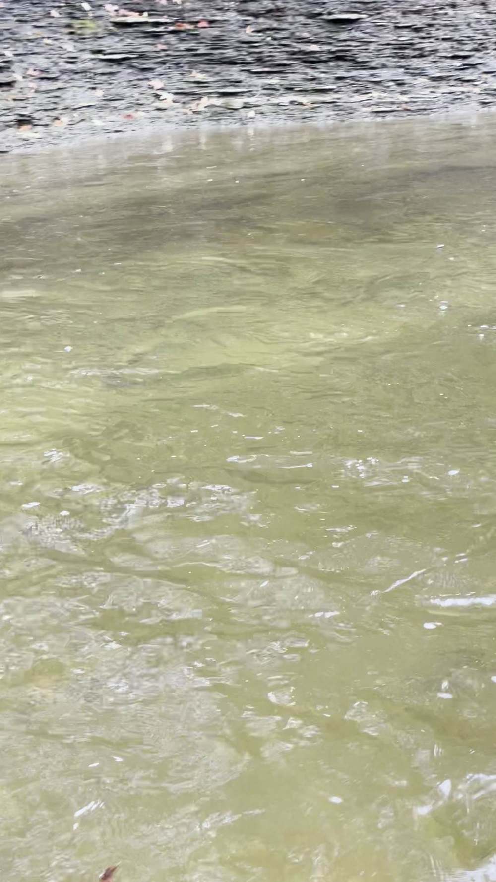
Stained and colouring on the rise — estimate from the rising hydrograph; not a visual reading
Call on the day
GOOD — up from baseflow and rising on the rain, an urban river with real flow; colour will follow the rise
Weather at the creek (Toronto — lakeshore station, weather.com, Nov 12, 2026): morning showers ending, 45°F at dawn, high 46°F / low 35°F, wind NE 15–18 mph gusting 25, sunrise 7:07 AM EST, sunset 4:55 PM EST. Regional context: the west set shares one weather system this week. The Nov 10–11 rain lifted every creek in the pack, and today the region is easing and clearing on a cold northeast wind. The Humber answers rain fast — it is an urban watershed, and pavement talks to this river quickly — so its rise arrives early and its clearing does too. Today sits in the middle of that exchange: flows up and still rising this morning, colour coming with the rise, and the clearest water a day or two behind the crest. Fish today for movement, not for visibility.
Gauge history: on Oct 27, 2026, Weston read 1.82 m³/s (64 cfs) and Elder Mills read 1.12 m³/s (40 cfs) — late-October baseflow for an urban river. Today Weston is at 2.80 m³/s, about one and a half times its base, and Elder Mills is at 1.38 m³/s, about 1.2 times its base — the same pattern as the rest of the set, the lower river taking the bigger lift. Placement is this gauge pair's real story. The Weston gauge sits in the lower river, inside the lake-run corridor — the best-placed gauge in the west set. It does not ask you to translate a headwater reading into a guess about the mouth; it reports the water at Raymore and Weston, a short run above the Eglinton line, in the reach where the fall fish actually stage. Elder Mills, upstream, is your early warning: what it gains today, Weston fishes tomorrow. Sources for this snapshot: Environment and Climate Change Canada (ECCC) hydrometric real-time feed (api.weather.gc.ca), stations 02HC003 and 02HC025, queried Nov 12, 2026 ~6:15 AM EST. All values provisional. Weather: weather.com, Toronto, Nov 12, 2026.
3A. Recent pushes / fresh runs
- Hooked Ontario weekly fishing report, Nov 9–15, 2026: tributary trout are rated "conditional — legal extended-season reaches may produce when flows permit; sanctuaries remain off-limits." On the Humber that translates directly: the all-year lower river and the extended-fall water to Highway 407 are the legal November options, and the sanctuary above Highway 407 stays shut.
- The gauge story (no catch report — run logic only): Weston climbed from 2.12 to 2.82 m³/s across the past 24 hours on the Nov 10–11 rain, roughly a fifty-percent lift over the Oct 27 baseflow at the same station. On an urban lake-run river, that is the push: lake fish stage at the mouth on a rise and run the park corridor as the water builds, then hold in the deep park pools as it crests. Today, easing and clearing regionally on a cold NE wind, the Humber is the set's quickest clearer once its crest passes — check Weston again before you go, because this river can be a different river by evening.
04 — The Water
4. Flow bands — go / wait / stay home
No published go / wait band exists for the Humber River — no conservation-authority, ministry, or shop band keyed to the Weston or Elder Mills gauges was found for this build, and this guide will not invent one and call it published. What follows are this guide's method bands, built only from the verified readings in this packet: the Oct 27, 2026 baseflow (Weston 1.82 m³/s / 64 cfs; Elder Mills 1.12 m³/s / 40 cfs), today's readings (Weston 2.80 m³/s / 98.9 cfs; Elder Mills 1.38 m³/s / 48.7 cfs), and the past-24h ranges. Read them at Weston, the gauge inside the fishery; Elder Mills confirms the trend.
- Low / base — Weston at or below about 2.1 m³/s (75 cfs): baseflow country, the bottom of today's
24-hour range and below. GO, but fish it as low, clear urban water: the deep park pools hold the fish, the riffles are thin, and stealth matters in a river this watched.
- Prime — Weston about 2.1 to 3.2 m³/s (75–113 cfs): GO. Today's 2.80 m³/s sits squarely in this window — an urban river with real flow, fish moving and holding through the whole park corridor.
- High — Weston about 3.2 to 4.3 m³/s (113–152 cfs), roughly 1.75 to 2.4 times the Oct 27 base: WAIT, or fish the softest park-pool edges only. Colour will be at its worst in this band — the urban watershed delivers its sediment fast — and the corridor's trails and underpasses begin to earn their floodplain name.
- Blowout — Weston above about 4.3 m³/s, more than about 2.4 times baseflow, or rising hard through that line: STAY HOME. This river's own history (§ Lore) is the reason the band exists. A Humber at well over twice base and climbing is a flood-management story, not a fishing story.
These are method bands, not a published band, not a flood stage, and not a promise. They exist so a buyer can turn one gauge reading into one decision — and they will be revised in the living edition as more verified readings accumulate.
05 — Section
5. The run, the fish, and the rules
The fishery: the Humber is Toronto's salmon river. Every fall, from late September to mid-October at the peak, Chinook salmon push up from Lake Ontario and leap the weir at the Old Mill — a jump of about a metre and a half at Étienne Brûlé Park that draws steady crowds, per Destination Ontario's salmon-run guide built on TRCA material. Coho follow in smaller numbers, steelhead run fall through spring, and brown trout work the lower river. Fish passage here is engineered and specific, and TRCA's own account draws the distinction this guide follows: the structure at Étienne Brûlé Park is a notched weir — the notch in its centre is lowered to improve salmon passage, and the structure also blocks invasive sea lamprey and round goby from moving upstream — while the weir at Raymore Park has a built-in fish ladder to help fish navigate upstream (TRCA, Salmon in Toronto and GTA Waters). Atlantic salmon, locally extinct for roughly a century, are the restoration story:
TRCA records Atlantic restoration stocking on the Humber beginning in 2011, part of the Lake Ontario Atlantic Salmon Restoration Program. This is a watched, managed, urban fishery — expect company, expect rules to be enforced, and expect the fish to be exactly as wary as that sounds.
The seasons (FMZ 16): zone-wide, rainbow trout are open the 4th Saturday in April to September 30, limit S-2, C-1 — and then the Humber's waterbody exceptions take over:
- Eglinton Avenue to Lake Ontario (City of Toronto, between Eglinton Avenue and Lake Ontario):
OPEN ALL YEAR for Atlantic salmon, brown trout, Pacific salmon, and rainbow trout. The whole park corridor below Eglinton — Étienne Brûlé, Magwood, the marshes, the mouth — is open today and every day.
- Eglinton Avenue to Highway 407 (Humber River and tributaries upstream from Eglinton Avenue to the south side of the Highway 407 bridge): EXTENDED FALL SEASON to December 31. Open today — Raymore Park and the Weston water live in this reach, under this season.
- Upstream from Eglinton Avenue — combined limit: a waterbody exception caps brook, brown, and rainbow trout combined at S-2, C-1 in the Humber River and tributaries upstream from Eglinton Avenue.
Three species, one small combined limit — plan to release fish here.
- Upstream of Highway 407: SANCTUARY — Humber River and tributaries upstream of Highway 407, no fishing January 1 to the Friday before the 4th Saturday in April and October 1 to December 31. Closed today, Nov 12. The headwater river above 407 is not fall or winter water.
- At the mouth (FMZ 20, Lake Ontario waters): rainbow trout and Pacific salmon are open all year, rainbow limit S-2, C-1. In the creek itself, the FMZ 16 creek rules above govern.
Aggregate trout and salmon limit for FMZ 16 / 17 / 20: S-5, C-2 combined — the species and combined limits above sit inside that aggregate. Licence: to fish Ontario you need an Outdoors Card plus a fishing licence. The Outdoors Card costs $8.57 CAD plus 13% HST ($9.68 with tax) and is valid three calendar years. Non-Canadian resident licence fees (CAD, before HST): 1-day Sport $24.86 (the only licence that does not require an Outdoors Card), 8-day Sport $54.38, 8-day Conservation $31.52, 1-year Sport $83.19, 1-year Conservation $52.71. One-year licences expire December 31 of the licence year. Non-Canadian residents 18 and over need the card and licence — the Canadian-resident 65+ exemption does not apply to them, so non-Canadian residents 65 and over do need the card and licence — but a non-Canadian resident under 18 may fish without a card or licence when accompanied by a licence holder, with kept fish counting against that holder's limits (or may buy their own card and licence). Atlantic salmon are S-0/C-0 — catch and release only. FMZ 16 is in the Southern Bait Management Zone: live or dead baitfish or leeches may not be transported into or out of the zone. Buy online through Ontario's Fish and Wildlife Licensing Service. The City of Toronto's own fishing page states the same rule for its parkland: with a valid Outdoors Card and licence, you can fish almost anywhere on Toronto public lands — posted signs say where you can't. Sport (S) means full limits;
Conservation (C) means reduced limits, as printed above.
Verify in the current Ontario Fishing Regulations Summary — this summary is not the law.
06 — Access
6. Access, pool by pool — area-level only
Area-level only, from City of Toronto and TRCA sources. The Humber's rule is the opposite of most tributaries: between the parks, banks run through residential Toronto — park access is the access. If it is not a city park below, do not assume you can get to the water lawfully.
- Étienne Brûlé Park (City of Toronto, at the Old Mill) — the historic first stop on the lower river and the salmon-viewing capital of the city. TRCA places its notched weir here (see §5): watch Chinook attempt the roughly metre-and-a-half leap at the Old Mill weir in the fall, and fish the lower-river water around the park — the City of Toronto's fishing page lists the Lower Humber River at Étienne Brûlé Park as a Toronto fishing location. It sits in the all-year reach below Eglinton. Expect crowds in October; expect elbow room in November.
- Magwood Park (City of Toronto) — an 8.7-hectare forested park on the east bank of the Humber near
Jane Street and Dundas Street West (City of Toronto park listing). It is the quiet middle of the lower corridor: trail access to the river between the Old Mill water below and the Dundas crossing above, in the all-year reach. The Humber River Recreational Trail connects it to the parks on either side.
- Humber River Marsh (City of Toronto) — the mouth. The City of Toronto's fishing page lists the Humber River Marsh — the mouth of the Humber upstream to Lake Shore Boulevard West — as a Toronto fishing location. Humber Bay Park East is listed separately by the City and sits on Mimico Creek peninsulas east of the Humber mouth; it is a Mimico Creek / lake-shore park, not Humber mouth water. Fish the marsh edges as mouth water and the bay park shoreline as lake-edge water under the FMZ 20 note in §5; this is staging water, where lake fish wait for the rise that §3's gauge story describes.
- Raymore Park (City of Toronto, Weston / Etobicoke, Raymore Drive) — beside the Weston gauge (02HC003), in the extended-fall reach above Eglinton. Destination Ontario and TRCA both place the TRCA-built fish ladder here: the weir at Raymore Park has a fish ladder built in, and the park is the quiet upstream alternative to the Old Mill crowds for watching fish pass a barrier. As fishing access it is park access to the corridor at Weston — and its name carries the flood history told in the Lore section; the park exists where a street did.
- Smythe Park (City of Toronto) — listed plainly for what it is: Smythe Park runs along Black Creek, the Closure: the City's October 5, 2026 notice closes the Black Creek areas of Smythe Park west of Jane Street from October 19, 2026 to fall 2029.
Humber's tributary, between Jane Street and Scarlett Road, joining the Humber corridor at its downstream end. It is tributary access, not main-stem Humber access — Black Creek is a Humber tributary under the same FMZ 16 exception map (§5), and the park is the lawful way to reach its lower water. Do not present it, or fish it, as the main river.
- The rest of the corridor — the Humber River Recreational Trail stitches the parks together through the valley, and the trail is a way to scout and move between park accesses. It is not itself a licence to fish any bank it passes: houses, golf courses, and private valley land line the river between parks, and in residential Toronto a worn path to the water is usually somebody's lot line.
07 — Tactics
7. Flies, tactics, and seasonal playbook
Tackle Standard lake-run gear, city edition: a 10½–11½ ft float rod or a 9 ft 7 weight fly rod, main line 8–10 lb, fluorocarbon leaders to 6 lb. The Humber in the corridor is a smaller, shallower river than the Credit — at today's 98.9 cfs at Weston it fishes like a big creek, and your rig should be scaled to it. Bring a net with a long handle: park banks, armour stone, and trail edges make for awkward landings.
Flies and baits Roe bags, small — dime-size in natural netting — for the lower river's pressured steelhead. Pegged beads, 8 mm first, in washed roe and pale orange tones. Egg patterns and small nymphs (hare's ear, prince, stonefly) for indicator work in the park pools. Pink worms when the river colours, as it is doing today. Small spinners and spoons for browns in the marsh and mouth water at first and last light. Salmon in the all-year reach are fall fish — egg patterns and roe are the honest menu; snagging is not a technique, it is an offence, and this river is watched.
How to fish it Fish the pools the parks give you, in order, moving like the trail does. Start at the mouth and marshes on a rising gauge — staging fish first — then work up the corridor pool by pool: the Old Mill water at Étienne Brûlé, the Magwood runs, and, under the extended season, the Raymore water at Weston. In each pool, the float drift is a short, controlled pass down the seam on the park side; these are small pools by tributary standards and they fish out fast, so one clean drift beats an hour of casting. Cross-check the Weston gauge between parks, not just before you leave: on a rising urban river, the pool you start at dawn is not the pool you finish at noon. Rest a pool after a fish — the next steelhead in a city pool is usually already there, watching you decide to leave.
Seasonal playbook
| Fall (Sep–Nov) | the salmon show. Chinook leap the Old Mill weir from late September, peaking to mid-October, with coho behind them and steelhead building through November in both the all-year lower river and the extended-fall reach to Highway 407 — today's pattern. |
| Winter (Dec–Feb) | steelhead in the all-year reach below Eglinton, plus extended-fall water until Dec 31. |
The corridor's deep park pools are the winter address. Ice on the valley trails is the gatekeeper.
Spring (Mar–Apr)
spring steelhead in the all-year and extended reaches; above Highway 407 the sanctuary owns the river until the Friday before the 4th Saturday in April. Opener unlocks the headwaters under the combined S-2 / C-1 trout limit upstream of Eglinton.
Summer
the lake-run fishery rests. The lower river is a warm urban fishery — bass and panfish in the marsh and bay water — and the corridor belongs to the trail. This guide's water is a fall-to-spring fishery.
08 — Section
8. Techniques in depth — fishing the Humber River
The primary rig: a light float rig for small, watched pools The Humber's steelhead rig is the float rig scaled down a full size from the big-river standard, because the water is scaled down: at Weston's prime band you are fishing pools a short cast across, in 75–113 cfs. Run a compact float carrying a string of small shot in a shirt-button spread — no single bulk mass — down a 30-inch fluorocarbon leader, with the bait set six inches off bottom. The shirt-button pattern is the point: in shallow park pools a bulked rig lands like a handful of gravel and fishes clumsy, while the spread shot lets the bait drift at the pool's own speed, ticking lightly, the float travelling true at surface pace. In the deeper Old Mill and Raymore pools, add depth before you add weight. The check is constant: a Humber float that drags under without a fish is a rig announcing itself to fish that have watched rigs all fall.
Bait selection by clarity Clarity is the Humber's fast-moving variable, and §3 estimates today's: stained and colouring on the rise. In today's water, fish a 10 mm pegged bead or a small roe bag in natural netting, a size up from your clear-water standard, tight to the seams. In clear baseflow water (the §4 low band), this river demands the smallest menu in the west set: an 8 mm bead, a dime-size bag, 6 lb leader, and a presentation that arrives without a splash — park-pool steelhead in gin-clear water have seen every bead in the catalogue. In the short, dirty window on a hard rise, a pink worm under the float in the softest inside water is the urban classic, because rising Humber fish hold against the banks where the current lets them rest — often in water your trail boots just walked past.
Forage notes — Humber River in mid-November The Humber's salmon calendar is printed on its banks: Chinook push up from the lake from late September to a mid-October peak, leaping the roughly metre-and-a-half notched weir at the Old Mill in Étienne Brûlé Park, with coho behind them and a fish ladder passing fish at Raymore Park. By mid-November that egg pulse is spent, and egg presentations lead for the steelhead running fall through spring through the connected park corridor the Weston gauge reads so well. No recommendation here applies upstream of Highway 407 — that water is a fish sanctuary, closed October 1 to December 31 (§5). Shiners hold deep off the mouth at Humber Bay; crayfish are tucked into the valley rock and inactive, and stoneflies drift the park pools year-round.
Lead — eggs (roe)
roe bags, beads (6–10 mm) and single eggs, sized to clarity — a 10 mm pegged bead or small bag in natural netting in stained, colouring water; the smallest menu in the west set in clear baseflow — an 8 mm bead, a dime-size bag, 6 lb leader (§8).
Secondary — sculpins and stoneflies
sculpin patterns and stonefly nymphs in the deep park pools — second to eggs.
Mouth and lower reach only — shiners
at the mouth and in the all-year reach below Eglinton, a live shiner on a bobber is a standing go-to, where the zone rules allow live bait.
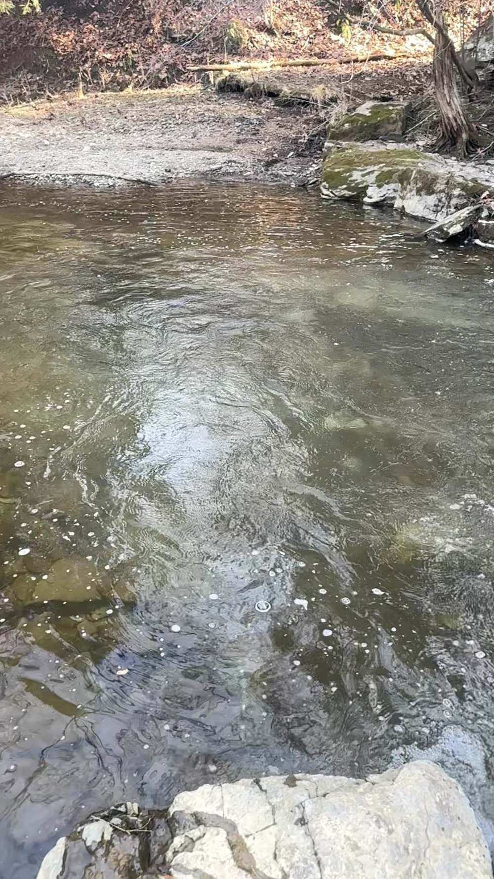
Where they hold, by level At baseflow (Weston near 1.82 m³/s, the Oct 27 reading), the corridor contracts to its deep water: the pool below the Old Mill weir, the deepest Magwood runs, and the Raymore pool hold the fish, and the connecting riffles are empty travel lanes. At prime flow — today's 2.80 m³/s — fish distribute through every park pool and the seams between them; walk the trail, fish a pool, walk on. At high water (§4's high band and above), the river rearranges itself against its banks: steelhead hold in the flooded trail-side edges, behind armour stone and bridge abutments, and in the marsh at the mouth — and the correct response to the top of that band is to watch it from the bridges, not wade it. Fish the falling side as the river drops back through prime: fish that ran on the rise settle into the park pools in order, mouth first.
The secondary method Indicator nymphing on the fly rod is the Humber's secondary method, and in the park pools it can outfish the float outright. A 9 ft 7 weight, a floating line, and a two-fly rig — a weighted stonefly or hare's ear under a small egg pattern, under an indicator set to the pool's depth — fishes the short, deep slots at Étienne Brûlé and Raymore with a delicacy no float rig matches, and it covers the water at your feet in the crowded fall pools without a backcast over the trail. Mend upstream, keep the drift dead, and set the indicator on any hesitation: in water this watched, takes are a pause, not a plunge. Swing a small streamer only in the wide tailouts — the marsh edges at first light — where there is room for the method to breathe.
Seasonal adjustment The Humber's seasonal adjustment is written into its season map. After October the salmon are done and the crowds vanish with them; November steelheading in the park corridor is a lighter rig, a smaller bead, and pools rested by the exodus — today's fishery. Winter narrows you to the all-year reach below Eglinton and slows the drift to the pace of cold water in deep pools. Spring reverses the flow of people before it reverses the flow of the river: the all-year reach carries the spring run while the sanctuary above Highway 407 keeps the headwaters shut until opener, and the combined S-2 / C-1 limit above Eglinton makes the upper river a release fishery in practice — rig light, handle fish wet and fast, and put them back in the pool you borrowed them from.
09 — Section
9. Safety
The Humber's safety section starts with its history, because this river has already shown Toronto what it can do (see Lore). Rising water: an urban watershed answers rain in hours, and Weston rose 0.70 m³/s in the past day on rain that has already ended. Check the gauge before you go and again while you fish; know which trail exit you will use on every pool; and treat underpasses, low trail sections, and marsh boardwalks as flood infrastructure, not shortcuts, on a rising river. Weirs: the Old Mill weir and the Raymore weir are low-head structures — deep, aerated, recirculating water below a weir is dangerous out of all proportion to how calm it looks. Fish them from the bank at a distance; never wade the plunge pool. The city around it: valley trails are shared space — watch for cyclists on blind bends, keep hooks clear of the trail on your backcast, secure valuables in park lots, and plan around a 4:55 PM sunset today; the valley goes dark before the city above it does. Ice and banks: the lower Humber's banks are armour stone, riprap, and wet clay under leaf litter — cleats earn their keep from November on, and shelf ice on the park pools is a mid-winter constant.
10 — Section
10. What is inside the living edition
Same promise as every Keystoned Steel guide:
- Live Water Survey of Canada gauges at Weston (02HC003) and Elder Mills (02HC025) — real readings, stamped with the time the gauge took them; where a gauge is not reporting, the guide says so plainly instead of faking a number.
- Live weather & radar built right into the guide.
- Verified access where it exists — and where access is private, fee-based, or permission-only, the guide says so plainly instead of faking a parking lot.
- Flow windows — the method bands that say go, wait, or stay home, printed with their sources.
- Buy once — updates to the guides you bought are free. A living edition that stays current all season.
Sources (Nov 12, 2026 build)
- Environment and Climate Change Canada (ECCC) hydrometric real-time feed (api.weather.gc.ca), station
02HC003 (Humber River at Weston), queried Nov 12, 2026 ~6:15 AM EST: 2.80 m³/s (98.9 cfs) at 5:50 AM EST Nov 12, 2026, level 2.225 m, past-24h range 2.12–2.82 m³/s; Oct 27, 2026 comparison 1.82 m³/s (64 cfs). All values provisional.
- Environment and Climate Change Canada (ECCC) hydrometric real-time feed (api.weather.gc.ca), station
02HC025 (Humber River at Elder Mills), queried Nov 12, 2026 ~6:15 AM EST: 1.38 m³/s (48.7 cfs) at 5:30 AM EST Nov 12, 2026, level 5.492 m, past-24h range 1.22–1.41 m³/s; Oct 27, 2026 comparison 1.12 m³/s (40 cfs). All values provisional.
- Ontario Fishing Regulations Summary, FMZ 16 (Humber River waterbody exceptions and sanctuary; zone-wide rainbow trout season and limits; aggregate trout + salmon S-5 / C-2), as provided in the verified build packet, Nov 12, 2026: all-year reach Eglinton Avenue to Lake Ontario; extended fall Eglinton Avenue to Highway 407; combined brook / brown / rainbow limit upstream of Eglinton S-2 / C-1; sanctuary upstream of Highway 407. FMZ 20 mouth rules as provided in the packet.
- Ontario Fish and Wildlife Licensing Service fee schedule (Outdoors Card and non-Canadian resident licence fees, CAD, HST noted), as provided in the verified build packet, Nov 12, 2026.
- Hooked Ontario weekly fishing report, Nov 9–15, 2026 (tributary trout "conditional" rating), as provided in the verified build packet, Nov 12, 2026.
- Weather: weather.com, Toronto, Nov 12, 2026 (morning showers ending, 45°F at dawn, high 46°F / low
35°F, wind NE 15–18 mph gusting 25, sunrise 7:07 AM EST, sunset 4:55 PM EST), as provided in the verified build packet.
- Toronto and Region Conservation Authority (TRCA), Salmon in Toronto and GTA Waters (trca.ca), checked Nov 12, 2026: the structure at Étienne Brûlé Park is notched in the centre to improve salmon passage and blocks invasive sea lamprey and round goby; the weir in Raymore Park has a fish ladder built in; Atlantic salmon locally extinct for about 100 years and returning under the Lake Ontario Atlantic Salmon Restoration Program; Humber River Atlantic restoration stocking began in 2011.
- Destination Ontario, Salmon run viewing spots (destinationontario.com), checked Nov 12, 2026: the
Humber is the largest watershed in Toronto and among the most reliable GTA salmon-viewing rivers;
Chinook leap the weir at the Old Mill Dam, a jump of about a metre and a half, at Étienne Brûlé Park, late September to mid-October; a fish ladder built by TRCA at Raymore Park passes fish at a second barrier.
- City of Toronto, Fishing page (toronto.ca), checked Nov 12, 2026: with a valid Outdoors Card and fishing licence, fishing is permitted on Toronto public lands; listed Toronto fishing locations include the Humber
River Marsh (mouth of the Humber upstream to Lake Shore Boulevard West), the Lower Humber River at Étienne Brûlé Park, and Humber Bay Park East.
- City of Toronto, Magwood Park listing (toronto.ca), checked Nov 12, 2026: 8.7-hectare forested park on the east bank of the Humber River near Jane Street and Dundas Street West. City of Toronto facility listings, checked Nov 12, 2026: Raymore Park (Raymore Drive, Etobicoke) and Smythe Park (Black Creek Boulevard) listings.
- TRCA, Hurricane Hazel's Legacy (trca.ca) and TRCA 50th Annual Meeting remarks, checked Nov 12,
2026: Hurricane Hazel, October 1954, caused the loss of 81 lives in the Toronto region; the Metropolitan Toronto and Region Conservation Authority (now TRCA) was established February 1, 1957, following the region's flood history including Hurricane Hazel; TRCA has operated since 1957 under the Conservation Authorities Act.
- TRCA, Humber River Watershed Tour book (2026), checked Nov 12, 2026: the Humber valley is part of the Toronto Carrying Place Trail, the Indigenous travel, trade, and communication route connecting Lake Ontario to Lake Simcoe; the Seneca village of Teiaiagon — "village at the crossing" — stood in what is now the Baby Point area, just north of Old Mill, the last stopping point before the portage; at Raymore Park, Hurricane Hazel swelled the river to four times its normal size.
- Canadian Heritage Rivers System / Humber River designation records and Humber watershed histories, checked Nov 12, 2026: the Humber was designated a Canadian Heritage River on September 24, 1999; the Toronto Carrying-Place Trail ran from Lake Ontario up the Humber to Lake Simcoe and the upper Great Lakes; Étienne Brûlé is believed to have been the first European to encounter the Humber, travelling the trail in 1615 on a mission from Samuel de Champlain; on Raymore Drive in 1954, 60 homes were destroyed and 35 people were killed.
- Humber River naming histories (Humber Valley Heritage Trail Association; Humber River watershed histories), checked Nov 12, 2026: earlier names included the Toronto River and St. John's River, and the Mississauga name Kabechenong, "gathering place to tie up"; after the Toronto Purchase of 1787, Lieutenant-Governor John Graves Simcoe renamed the river Humber, after the Humber in England.
Lore, Legends & History Stand at the Old Mill weir in October, watching a Chinook gather itself and throw its whole silver length at a metre and a half of falling water, and you are standing at the bottom of one of the oldest roads in Canada. The fish does not know that. The road was never for fish.
The Humber was the southern end of the Toronto Carrying Place — the great portage route that linked Lake Ontario to Lake Simcoe and, beyond it, Georgian Bay and the upper lakes. Canoes came in off Lake Ontario at the mouth, and travellers took to the trail north beside the water, carrying boats and goods overland to the Holland River watershed and the lakes beyond. Indigenous nations built and used that route for centuries — the Anishinaabe name recorded for the river, Gabekanaang-ziibi, is translated as "river at the end of the trail," which tells you exactly what the Humber was: not a destination, a doorway. In the 1660s the Seneca kept a permanent village, Teiaiagon — rendered in the conservation authority's watershed tour as "village at the crossing" — on the east bank near today's Baby Point, just north of the Old Mill, the last stopping point before the portage began in earnest. Trade, diplomacy, and war all passed through that village and up that trail. In 1615, it is believed, a young French interpreter named Étienne Brûlé travelled the Carrying Place on a mission from Samuel de Champlain — the first European recorded on this shore, passing, tradition holds, through the valley you now fish from a city park that bears his name.
The name on the modern map is younger and blunter. The river carried many names first — the Toronto River, St. John's River on early maps, Tanaovate beside Tejajagon on a 1733 chart, Kabechenong in Mississauga usage, "gathering place to tie up." After the Toronto Purchase of 1787, Upper Canada's first lieutenant-governor, John Graves Simcoe, set about renaming the province in England's image, and the river became the Humber, after the Yorkshire estuary — part of the same naming program that briefly tried to make Toronto into York. The trail faded as roads and then railways took its traffic; mills rose on the lower river, including at the Old Mill site; the valley filled with farms, then suburbs, then postwar homes in the floodplain itself, on Raymore Drive and its neighbouring streets, in the river's own room.
The river took its room back in one night. On October 15, 1954, the remnants of Hurricane Hazel stalled over southern Ontario and poured rain onto already-saturated ground. The Humber rose — by the conservation authority's watershed account, to four times its normal size in the lower valley — and went through the floodplain neighbourhoods like a demolition crew. Bridges went. Houses came off their foundations entire. On Raymore Drive alone, sixty homes were destroyed and thirty-five people died. Across the region, Hazel killed eighty-one people. Toronto has never had a night like it before or since, and the city answered it in the only durable way: it changed who owned the floodplain. The Metropolitan Toronto and Region Conservation Authority — today's TRCA — was established on February 1, 1957, in Hazel's long shadow, and the valley was bought back, cleared, and turned into the park chain you fish today. Raymore Park is not named to commemorate the street. It replaced it. That is the Humber's strange gift to an angler: its parks are a flood policy that turned into a fishery. In 1999 the river was designated a Canadian Heritage River, honoured for the Carrying Place and the valley's layered past.
The salmon leaping the notched weir at Étienne Brûlé Park are Pacific fish in an Atlantic watershed, jumping a barrier modified to let them pass and to stop lamprey behind them, below a village site older than the city, on a river renamed for an English estuary, in a park that exists because the water once rose and the city finally listened. Fish it with that in your head and the Humber stops being the city river. It becomes what it always was — the end of the trail, and the start of one.
Night fishing — working the holes after dark First, the law on this water. Ontario night fishing runs under the OMNRF zone rules for this water plus any sanctuary and park or conservation-area hours this guide lists — several creek-mouth sanctuaries and park accesses on this shore close seasonally or keep day-use hours. Where this guide lists a closure or an access schedule, it governs: be out of closed water and out of the access on time, and fish the tactics below only where the night is open. Everything upstream of Hwy 407 is sanctuary water, closed October 1 to December 31 (§5) — the night fishery in this guide is the all-year lower reach and the mouth.
After dark, the run changes address on Humber River, ON. Steelhead that travelled and held in the fast water by day settle into the deep holes — the slow, dark water at the head of the pool, along the ledge and the undercut bank, and the soft seam beside the fast tongue — and they feed there with a confidence they never show at noon. The deep holes are the night fishery: fewer fish moving, more fish eating.
Working a hole in the dark is a memory exercise before it is a fishing exercise. Fish the hole in daylight first: learn where it deepens, where the wood and the ledges sit, where you will stand, and where a hooked fish can be landed. At night, work it top to bottom in short steps — a cast or two across the head, down the seam, into the tail — slow, deep and close to the bottom, with long pauses; a steelhead at night does not chase, it intercepts.
Two profiles speak at night: glow — a glow bead, glow egg or chartreuse presentation where a little light helps the fish find it — and dark — a black or black-olive streamer or nymph silhouetted against the night sky. The
dark profile works because it reads to a night-feeding fish as a bottom forage fish on the move — big, slow, and tight to the substrate. Light discipline is not optional: a headlamp shone into a hole ends the fishing in it — keep the light on the bank and on your feet, red or dim when you have it, and rest a lit-up hole before fishing it again.
Sound carries the same way. Safety doubles after dark: never wade at night water you have not waded by day, belt cinched and staff in hand, tell someone the reach and the return time — a fall in cold water at night is a survival event, not a soaking. Tonight's night pick — kept live with this guide's bait rotation. The rotation updates the night pick for this water on the same cycle as the day picks, off the forage calendar and the current clarity and flow.
Current-season default: a glow roe bag under a float at the head of the hole; dark second, a black streamer swung at a crawl along the seam.
11 — Posted & Access
Posted Land & Access Trails
The Humber is the inverse of most Ontario tributaries: after Hurricane Hazel, its lower floodplain became city parkland, so the public doors are a near-continuous chain of City of Toronto parks from the lake to Eglinton Avenue and a sparser set of park and trail doors above it — but the chain is parks, not a bank-walking right, and the City itself lists only four Humber fishing locations on its fishing page. The river is a designated Canadian Heritage River, the GTA's only one (TRCA). Below Eglinton the water is open all year; above Eglinton an extended fall season runs to Highway 407 under a tight combined trout limit; above Highway 407 the river is a fish sanctuary for most of the year. Fish the named parks, respect the Eglinton and Highway 407 lines, and treat the residential and golf-course banks between the parks as private. Checked November 2026.
The public water — access areas & easements
Mouth to upstream. The City of Toronto's fishing page states the ground rule for every stop below: with a valid Outdoors Card and fishing licence, "you can fish almost anywhere on Toronto public lands," and "posted signs will let you know where you can and can't fish" (City of Toronto, Fishing). The same page names the Humber locations in stops 1, 2, 4 and 6; where a stop is not on that list, the chapter says so.
Humber Bay Park East — the lake-edge door (City of Toronto, 100 Humber Bay Park Road East)
Listed on the City's fishing page as a Toronto fishing location (City of Toronto, Fishing). Place it correctly: Humber Bay Park is a waterfront park of over 43 hectares made of two peninsulas — Humber Bay Park East and Humber Bay Park West — bisected by Mimico Creek, south of Lake Shore Boulevard West near Park Lawn Road (City of Toronto, Humber Bay Park Master Plan). It sits at the mouth of Mimico Creek, east of the Humber's mouth, and reaches the Humber mouth along the shoreline and the Humber Bay Arch Bridge. Fish it as lake-edge and staging water beside the mouth, not as riverbank on the Humber itself. The Master Plan page notes planned improvements in Humber Bay Park East (East Entrance Meadow and Pond, Linear Wetland), with landscape and wetland work planned for completion in 2026 and associated buildings anticipated in 2029–2030 — expect construction fencing to move the usable shoreline; obey it.
Humber River Marsh — the mouth (City of Toronto)
The City's fishing page lists it in these words: "Humber River Marsh: mouth of Humber River upstream to Lake Shore Boulevard West" (City of Toronto, Fishing). This is the actual river-mouth door: the marsh water at the mouth, upstream only as far as Lake Shore Boulevard West under the City's listing. The City page gives no parking, trail or facility detail for the marsh, and none is printed here.
King's Mill Park (City of Toronto, west bank, south of Bloor Street)
A City park on the lower river, immediately south of the Old Mill / Étienne Brûlé water. The City's Mar. 24, 2026 boat-club report places the Toronto Humber Yacht Club "within King's Mill Park along the Humber River on approximately 2.06 acres of leased land within the regulated floodplain," on TRCA-owned lands managed by the City under the 1972 Management Agreement, directly adjacent to the river within the hydraulic floodway (City of Toronto, Supplementary Report GG27.14). Two things follow. First, the park is public river-valley land on TRCA ownership — that is the access. Second, the yacht-club parcel inside it is a private leased club (over 100 members, 50–60 motorized boats, 35+ docks over roughly 300 metres of shoreline in the City's description), not a public marina, and City staff determined its lease should not be renewed, with the club remaining in 2026 only on a month-to-month overhold while the City and TRCA plan decommissioning and future public uses (same report). Do not fish from the club's docks, and expect this parcel's status to change. The City's fishing page does not list King's Mill Park as a separate fishing location; the listed lower-river location is the next stop.
Étienne Brûlé Park — the Old Mill water (City of Toronto, 10 Catherine Street)
The City's fishing page lists "Lower Humber River at Etienne Brule Park" as a Toronto fishing location (City of Toronto, Fishing). TRCA places the lower river's key structure here: "the structure at Etienne Brule park keeps invasive Sea Lamprey and Round Goby from moving upstream. The 'notch' in the centre of the structure is lower and this modification improves access for Salmon" (TRCA, Salmon in Toronto and GTA Waters). This is the salmon-viewing and salmon-fishing capital of the lower river, in the all-year reach below Eglinton. Fish the park water; the weir structure itself is a barrier and a hazard, not a fishing platform (see the existing guide's safety chapter on low-head weirs).
Magwood Park (City of Toronto, 1 Pasadena Gardens)
An 8.7-hectare forested park on the east bank of the Humber River near Jane Street and Dundas Street West, with a basketball court and a children's playground (City of Toronto park listing, as carried in the City's park data). The City's Teiaiagon–Baby Point Heritage Conservation District plan groups Magwood Park, Étienne Brûlé Park and part of Cashman Park as the parks that "provide access to the Humber River" (City of Toronto, Teiaiagon–Baby Point HCD Plan, Nov. 2024). It is trail-and-bank access in the all-year reach, between the Old Mill water below and the Dundas crossing above. The City's fishing page does not list Magwood Park as a separate fishing location — the listed location for this corridor is Étienne Brûlé Park (stop 4) — so fish here under the City's general public-lands rule and the posted signs, and do not cut through the Baby Point residential lots that back the park.
Eglinton Flats (City of Toronto, Jane Street / Eglinton Avenue West)
Listed on the City's fishing page by name — "Eglinton Flats" — as a Toronto fishing location (City of Toronto, Fishing). TRCA's urban fishing guide places it at the southeast corner of Jane and Eglinton Avenue, and Destination Ontario's Toronto fishing list treats the flats' water as Topham Pond, a warmwater pond fishery at Jane and Eglinton West. Print it for what the sources support: a City-listed fishing location sitting on the Eglinton Avenue regulation boundary itself — the river below Eglinton is the all-year reach, the river and tributaries above it are the extended-fall reach under the combined limit (see Seasonal). Which side of the avenue your line is on decides which season and limit you are fishing under. The City sources opened for this build do not describe a developed mainstem riverbank fishery at the flats, and none is printed.
Raymore Park (City of Toronto, 93 Raymore Drive, Etobicoke)
A City park on the river at Weston, in the extended-fall reach above Eglinton. TRCA: "Other weirs, such as the one in Raymore Park along the Humber River, have fish ladders built in to help fish navigate their way upstream" (TRCA, Salmon in Toronto and GTA Waters). TRCA's Humber River Watershed Tour book (Sept. 23, 2026) treats Raymore Park as a Lower Humber site, records the 2017 erosion-control work on a stretch of the east bank there, and calls the structure the "Raymore fishway built into the weir," a popular spot to watch salmon migration in the fall. The park exists where Raymore Drive's houses stood before Hurricane Hazel — floodplain bought back and parked, which is why the access exists at all. The City's fishing page does not list Raymore Park as a separate fishing location; fish it as City parkland under the extended-fall season and the combined limit, and obey posted signs.
Humber Arboretum — the West Humber door (Humber Polytechnic / City of Toronto / TRCA, Humber College Boulevard, North Etobicoke)
"Humber Arboretum exists as a unique tri-partnership between Humber Polytechnic, the City of Toronto, and the Toronto Region Conservation Authority. Covering approximately 100 hectares surrounding the West Humber River, Humber Arboretum offers public gardens and nature trails which are free to visit and open to all" (Humber Arboretum, humber.ca). Its self-guided material describes trails connecting down to the paved trail along the Humber River. This is a West Humber River door — tributary water, not the main stem — above Eglinton, so the extended-fall season and the combined brook/brown/rainbow limit govern it, and the Highway 407 sanctuary line governs the tributaries above it (see Seasonal). The Arboretum sources opened for this build name gardens and trails; they do not name fishing, and the Arboretum is not on the City's fishing-page list. It is printed as a free public trail door onto West Humber valley land — confirm fishing is not signed out at the reach you use, and fish only where the trail meets the water on public land.
The trail between the doors. The Humber River Recreational Trail stitches the lower parks together through the valley. It is a way to scout and move between park accesses; it is not itself a licence to fish any bank it passes. Houses, golf courses and private valley land line the river between parks, and in residential Toronto a worn path to the water is usually somebody's lot line.
Above the run. No City- or TRCA-named public fishing location above Highway 407 was verified in the sources opened for this build, and the water up there is sanctuary water for most of the year in any case (see Seasonal). TRCA's Humber page lists conservation areas and parks in the wider watershed (Albion Hills, Boyd, Claireville, Glen Haffy, Kortright, Nashville Conservation Reserve, among others) without tying any of them to a Humber River fishing access in the text opened; none is printed here as a river door. Treat the headwater banks as private until a manager's listing says otherwise.
Posted & private — stay out
Ontario access law — the spine
Ontario has NO purchased-easement chain like New York's PFR and NO statutory bank-walking right like Michigan's MCL 324.73102(3). The public doors are conservation-authority lands, municipal parks, provincial parks, and Crown beds — everything else is permission water.
Permission is the rule on private property
The Fish and Wildlife Conservation Act, 1997 prohibits fishing in contravention of the Trespass to Property Act: fishing on private property requires the occupier's permission (OFAH "Ask a CO," answered by MNRF's Provincial Enforcement Specialist: "generally a person can only fish or hunt on private property with permission from an occupier of that property").
The bed decides wading — reach by reach
Streambed ownership varies reach by reach on the same river — in the MNRF specialist's words, it "can vary significantly, both across the province and even within different stretches of an individual river or stream," and bed ownership may differ from the ownership of the banks beside it. If the bed is Crown, an angler may walk/wade the watercourse regardless of who owns the banks; if the bed is privately owned, wading needs the occupier's permission. Floating on navigable water is a navigation right; stepping onto a private bed is not. The Beds of Navigable Waters Act presumes the bed of a navigable water did NOT pass with a Crown grant absent an express grant — but pre-1911 and express grants can make beds private, so no reach's bed status can be asserted without checking; the MNRF district office is the arbiter — the OFAH answer directs landowners and anglers with bed-ownership questions to their local MNRF district office. No reach of the Humber River had its bed ownership verified for this build; this chapter asserts Crown-bed wading for no reach of this river. The park chain is the access because it is verifiable; do not extend it by wading past a park boundary on an assumption.
A licence is not a trespass permit
parking, bank use, and trails are the land manager's rules. In Toronto the manager's own qualifier matters: the City says you can fish "almost anywhere" on Toronto public lands — almost — and that posted signs tell you where you can and can't fish (City of Toronto, Fishing).
Private ground inside the park chain — the yacht club
The Toronto Humber Yacht Club parcel in King's Mill Park (stop 3) is a private leased club on TRCA-owned land, in month-to-month overhold after its lease expired July 31, 2025, with City staff having determined against renewal (City Report GG27.14, Mar. 24, 2026). Public park around it; private docks on it. Stay off the club's docks, clubhouse ground and moorings.
Smythe Park is tributary water, not a mainstem door
Smythe Park (City of Toronto, 61 Black Creek Boulevard) runs along Black Creek, the Humber's tributary, between Jane Street and Scarlett Road — it is not on the Humber main stem, it is not on the City's fishing-page list, and this chapter does not count it as a Humber River access stop. Black Creek is a Humber tributary under the same FMZ 16 exception map (extended fall above Eglinton; combined limit upstream of Eglinton), but lawful park access to Black Creek at Smythe is a separate question from mainstem access, and the park is about to change: the City's Rockcliffe Riverine Flood Mitigation construction notice (Oct. 5, 2026) puts Phase 1 works in and around Smythe Park from Oct. 19, 2026 to fall 2029, with areas of the park immediately west of Jane Street on either side of Black Creek closed during construction and pedestrian access from Jane Street closed, while access from Scarlett Road and Black Creek Boulevard is maintained. Do not plan on the Jane Street side of Smythe Park.
James Gardens / Lambton Woods — no verified fishing door
The City's Feature Garden Parks page describes James Gardens (99 Edenbridge Drive) as formal gardens with stone pathways, spring-fed pools and streams, "close to the Humber River and next to Ecologically Significant Lambton Woods" (City of Toronto, Feature Garden Parks). Close to the river is what the source says; a named river fishing access is what it does not say. James Gardens is a garden park on the corridor, not a verified fishing stop in this chapter, and Lambton's golf-course ground on the river is private club ground in any case.
Everything not named above is permission water
Between the parks, the lower Humber's banks run through residential Toronto, and above Eglinton through suburbs, golf courses and private valley land. If it is not a named City park, a TRCA property or the Arboretum, assume the bank is private, posted or not, and stay off it.
Seasonal & changing access
The regulation staircase (2026 Ontario Fishing Regulations Summary, FMZ 16, ontario.ca). Zone-wide in FMZ 16, Atlantic salmon, brown trout, Pacific salmon and rainbow trout run fourth Saturday in April to September 30; rainbow trout S-2/C-1, brown trout S-5/C-2, Pacific salmon S-5/C-2, Atlantic salmon S-0/C-0, and the aggregate limit for all trout and salmon combined is S-5/C-2. The Humber's own reaches then take over:
Open ALL YEAR: Humber River — City of Toronto, between Eglinton Avenue and Lake Ontario, for Atlantic salmon, brown trout, Pacific salmon and rainbow trout; zone-wide limits apply. Stops 1–5 fish under this season (stop 1 as lake-edge water at the mouth). Note the Atlantic salmon limit is S-0/C-0 zone-wide: the season is open, the possession limit is zero.
EXTENDED FALL, fourth Saturday in April to December 31: Humber River and tributaries — upstream from Eglinton Avenue in the City of Toronto to the south side of the Highway 407 bridge in the Regional Municipality of York; zone-wide limits apply, subject to the waterbody exception immediately below. Raymore Park (stop 7) and the Humber Arboretum's West Humber water (stop 8) fish under this season; Eglinton Flats (stop 6) sits on its boundary line.
WATERBODY EXCEPTION — combined limit upstream of Eglinton: Humber River and its tributaries upstream from Eglinton Avenue — brook trout, brown trout and rainbow trout combined limit S-2/C-1. Three species, one small combined limit; plan to release fish above Eglinton.
FISH SANCTUARY — upstream of Highway 407: Humber River and tributaries — Regional Municipalities of York and Peel and Counties of Dufferin and Simcoe, upstream of Highway 407 — no fishing January 1 to Friday before fourth Saturday in April and October 1 to December 31. The headwater river above 407 is not fall or winter water, and in spring it opens a day later than a casual reading suggests: the closure runs to the Friday before the fourth Saturday in April.
Changing ground. Three manager items outlive any single season: Humber Bay Park East's Master Plan works (landscape/wetland work planned to complete in 2026, buildings anticipated 2029–2030 — City Master Plan page); the Toronto Humber Yacht Club site in King's Mill Park, in overhold with decommissioning and future-use planning to come (City Report GG27.14, Mar. 24, 2026); and, on the Black Creek tributary, the Rockcliffe works closing parts of Smythe Park from fall 2026 to fall 2029 (City construction notice, Oct. 5, 2026). Check the manager's page for the park you are using before you go.
Heritage designation. TRCA states the Humber "is also the only Canadian Heritage River in the Greater Toronto Area," designated in 1999, "one of 40 across Canada," for its cultural heritage and recreational values, including the Toronto Carrying Place Trail (TRCA, Humber River watershed page). The designation honours the river; it grants no access rights. The parks grant the access.
Licence. A Pennsylvania resident is a "non-Canadian resident" in Ontario law. Anglers 18+ need an Outdoors Card ($8.57, valid 3 calendar years) PLUS a fishing licence — 2026 fees (ontario.ca, +13% HST): 1-year Sport $83.19, 8-day Sport $54.38, 1-day Sport $24.86 (the 1-day needs NO Outdoors Card), 1-year Conservation $52.71, 8-day Conservation $31.52. Licences run on the calendar year (expire Dec 31). Under-18 non-Canadian residents may fish under a licensed adult's limits. Carry the Outdoors Card + Licence Summary (the official PDF on a phone is valid; a screenshot is not). FMZ 16 is in the Southern Bait Management Zone: live or dead baitfish or leeches may not be transported into or out of the zone.
Report changes. Park construction, lease expiries and flood works change this river's access on City and TRCA schedules, not fishing seasons. If a sign or a fence on the ground disagrees with this chapter, the sign and the current Ontario Fishing Regulations Summary govern — and tell us, so the living edition can be corrected.
Sources for this section: Ontario Ministry of Natural Resources, 2026 Ontario Fishing Regulations Summary — Fisheries Management Zone 16 (ontario.ca): zone-wide seasons and limits (Atlantic salmon S-0/C-0; brown trout S-5/C-2; Pacific salmon S-5/C-2; rainbow trout S-2/C-1; aggregate trout and salmon S-5/C-2); species exceptions — Humber River, City of Toronto, between Eglinton Avenue and Lake Ontario, open all year, and Humber River and tributaries, upstream from Eglinton Avenue to the south side of the Highway 407 bridge (Regional Municipality of York), extended fall season to December 31; waterbody exceptions — Humber River and tributaries upstream from Eglinton Avenue, brook/brown/rainbow combined S-2/C-1, and Humber River and tributaries upstream of Highway 407 (York, Peel, Dufferin, Simcoe), fish sanctuary, no fishing January 1 to Friday before fourth Saturday in April and October 1 to December 31 (also listed in the page's fish-sanctuary list as "Humber River — refer to waterbody exceptions"); Southern Bait Management Zone note. OFAH, "Ask a CO" (ofah.org), answer by David Critchlow, Provincial Enforcement Specialist, MNRF (Fish and Wildlife Conservation Act, 1997 / Trespass to Property Act; Crown vs. private bed; MNRF district office). City of Toronto (toronto.ca): Fishing page (Outdoors Card + licence; "almost anywhere on Toronto public lands"; posted signs govern; listed locations — Humber River Marsh, mouth upstream to Lake Shore Boulevard West; Lower Humber River at Etienne Brule Park; Eglinton Flats; Humber Bay Park East); Humber Bay Park Master Plan page (over 43 ha; two peninsulas bisected by Mimico Creek; East improvements, landscape/wetland completion planned 2026, buildings 2029–2030); park listing data (Magwood Park, 8.7 ha, east bank of the Humber near Jane Street and Dundas Street West, 1 Pasadena Gardens; Raymore Park, 93 Raymore Drive; Smythe Park, 61 Black Creek Boulevard); Teiaiagon–Baby Point Heritage Conservation District Plan, Nov. 2024 (Magwood Park, Étienne Brûlé Park and part of Cashman Park provide access to the Humber River); Feature Garden Parks (James Gardens, 99 Edenbridge Drive, close to the Humber River, next to Lambton Woods); Supplementary Report GG27.14, Mar. 24, 2026 (Toronto Humber Yacht Club within King's Mill Park, ~2.06 acres leased, TRCA-owned lands, lease expired July 31, 2025, month-to-month overhold, staff determination against renewal); Rockcliffe Riverine Flood Mitigation construction notice, Oct. 5, 2026 (Smythe Park / Black Creek closures, Oct. 19, 2026–fall 2029). Toronto and Region Conservation Authority (trca.ca): Humber River watershed page (90,258 ha, largest in TRCA jurisdiction; only Canadian Heritage River in the GTA, designated 1999, one of 40 across Canada; Toronto Carrying Place Trail; watershed conservation areas/parks list); Salmon in Toronto and GTA Waters (Étienne Brûlé notched weir blocks sea lamprey and round goby, notch improves salmon access; Raymore Park weir has fish ladders built in; Humber Atlantic salmon restoration stocking began 2011); Humber River Watershed Tour book, Sept. 23, 2026 (Raymore Park site; 2017 east-bank erosion work; Raymore fishway); Urban Fishing Opportunities in Toronto & Surrounding Areas (Lower Humber River — Etienne Brule Park north of Bloor Street to Eglinton Avenue; Eglinton Flats — southeast corner of Jane and Eglinton Avenue; Humber River Marsh — upstream from the mouth). Destination Ontario (destinationontario.com), fishing close to Toronto (Topham Pond, Eglinton Flats). Humber Arboretum (humber.ca): tri-partnership of Humber Polytechnic, City of Toronto and TRCA; ~100 ha surrounding the West Humber River; public gardens and nature trails free to visit and open to all. Ontario licence framework and 2026 non-Canadian-resident fees (ontario.ca), as carried in the verified build packet for this pack. Checked November 2026.
The Bottom Line
The Humber should not work, and it does. This is a river that drains the largest city in Canada, runs past subway stations and subdivisions, and still pulls Chinook salmon over the Old Mill weir every fall in front of crowds on a city park bank, still sends…
Legal · Read last
LEGAL DISCLOSURE — Keystoned Steel Guides
What Keystoned Steel warrants. Keystoned Steel warrants only that, as of the edition date stated in this guide, the access, gauge, and regulation information in this guide that is attributed to a cited official source accurately reflects that source as published on that date. If a material error in that information is confirmed, Keystoned Steel will issue a corrected edition to the original buyer at no charge or, if it does not do so within 30 days after confirming the error, refund the price you paid. That is the sole express warranty provided with this guide. This guide does not warrant or guarantee: (a) Stream conditions, water levels, clarity, or weather — conditions change daily and can change after any reading printed here; (b) Fishing success — no representation is made that fish are present, in any number, size, or location, at any time; (c) Access — access status, parking, and public access rights can change, be posted, or be withdrawn at any time; inclusion of a reach in this guide is not permission to fish it, and is not a representation that access is currently open; (d) Third-party data — Gauge readings, including Water Survey of Canada / Environment and Climate Change Canada data, agency publications, and maps, originate from third-party sources. Keystoned Steel does not control those sources and cannot guarantee their accuracy, completeness, availability, or continued accessibility. Third-party information may be provisional, delayed, revised, or incorrect. Its inclusion does not constitute an independent guarantee by Keystoned Steel of the underlying data; (e) Regulations — seasons, creel and size limits, and special-reach rules change; the regulations summarized here are a convenience summary only and are not the law. Your responsibilities. Before you fish: confirm the current regulations in the current Ontario Fishing Regulations Summary (Ontario Ministry of Natural Resources); hold the required licence — in Ontario an Outdoors Card plus a valid fishing licence; verify access is open and lawful for the reach you fish; respect posted signs and private land — a fishing licence is not a permit to trespass. Wading and stream fishing involve inherent risks, including fast or rising water, slippery rock, and remote terrain; you fish at your own risk and are responsible for your own safety decisions. This safety warning and assumption of risk do not waive or limit any liability, warranty, or remedy that cannot lawfully be waived or limited under applicable law. Corrections and refunds.
If you believe this guide contains a material error, email keystonedsteel@gmail.com or message our Facebook Page with the guide name and the error. Keystoned Steel will review it against the cited sources within 30 days.
If the error is confirmed, you will receive a corrected edition or, at Keystoned Steel's election, a refund of the price you paid. That remedy is your sole and exclusive remedy for errors in this guide. Limitation of liability.
TO THE FULLEST EXTENT PERMITTED BY APPLICABLE LAW, KEYSTONED STEEL'S TOTAL LIABILITY ARISING OUT OF THIS GUIDE WILL NOT EXCEED THE PRICE YOU PAID FOR IT, AND KEYSTONED STEEL WILL NOT BE LIABLE FOR INDIRECT, INCIDENTAL, OR CONSEQUENTIAL DAMAGES, INCLUDING TRIP COSTS, CITATIONS OR FINES, OR PERSONAL INJURY ARISING FROM YOUR USE OF THIS GUIDE. NOTHING HERE LIMITS LIABILITY FOR GROSS NEGLIGENCE
OR WILLFUL MISCONDUCT. License. This guide is licensed to the original buyer for personal use only. It is nontransferable and may not be shared, resold, or redistributed without the prior written consent of Keystoned Steel. Living-edition updates are delivered only to the original buyer's purchase email. TO THE FULLEST EXTENT PERMITTED BY APPLICABLE LAW, THE WARRANTY SET FORTH ABOVE IS THE SOLE EXPRESS WARRANTY PROVIDED BY KEYSTONED STEEL FOR THIS GUIDE, AND KEYSTONED STEEL DISCLAIMS ALL OTHER WARRANTIES, EXPRESS OR IMPLIED, INCLUDING ANY IMPLIED WARRANTY OF MERCHANTABILITY AND ANY IMPLIED WARRANTY OF FITNESS FOR A PARTICULAR PURPOSE. NOTHING IN THIS DISCLOSURE SHALL EXCLUDE OR LIMIT ANY WARRANTY, RIGHT, OR REMEDY THAT CANNOT LAWFULLY BE EXCLUDED OR LIMITED UNDER APPLICABLE LAW.