
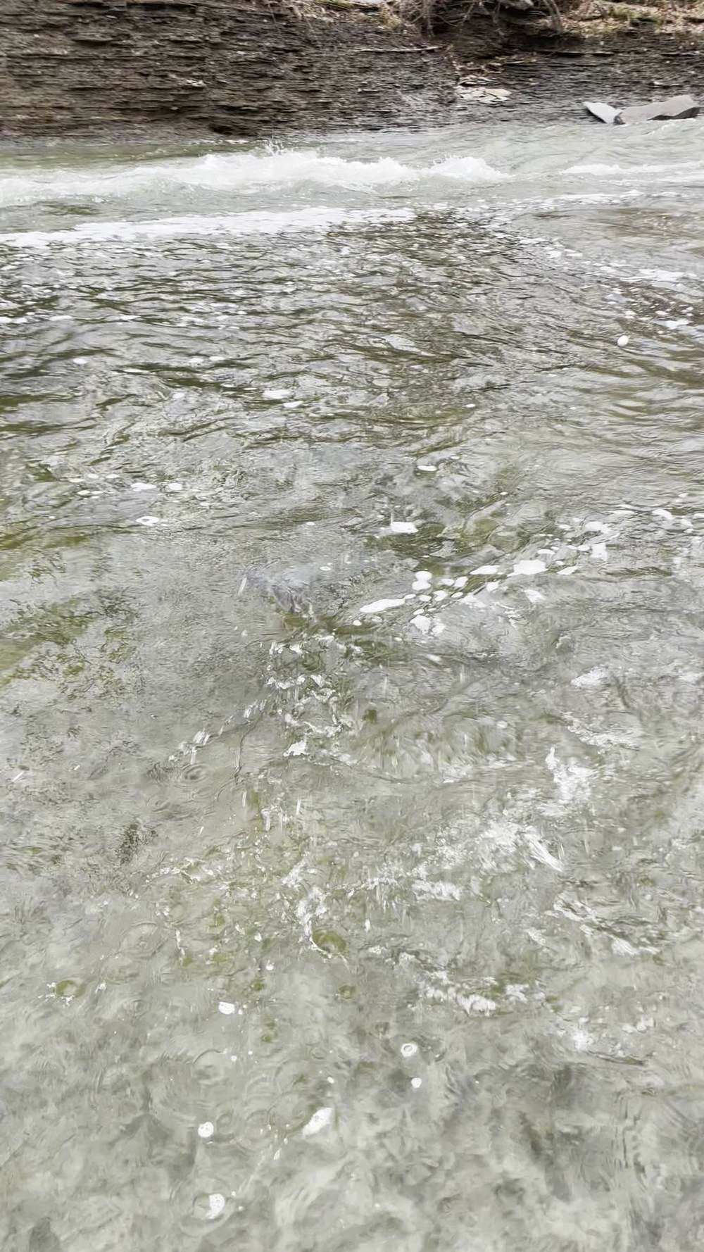
Keystoned Steel // Field Guide
Credit River
The brief
class="v-brief">What this guide covers: the lake-run water of the Credit River in Fisheries Management Zone 16 (FMZ 16), under Credit Valley Conservation (CVC) — the west set's flagship steelhead river, running from Lake Ontario at Port Credit through Mississauga to the extended-fall water, which ends at the south side of the Highway 407 bridge in Brampton (Norval is upstream of that line). This is a river of hard edges: an all-year reach at the bottom, a sanctuary in the middle that is closed today, and an extended fall season above it. Two live Water Survey of Canada gauges watch this river, and this guide uses both.
Sanctuary — read before you plan The Streetsville reach is closed today. Credit River and tributaries from the south side of the Highway 403 bridge upstream to the south side of the Britannia Road bridge — NO FISHING January 1 to the Friday before the 4th Saturday in April AND August 15 to December 31. On Thu Nov 12, 2026, that reach is in its fall closure. Fish the all-year water below Highway 403, or the extended-fall water from Britannia Road upstream to Highway 407 — and read §5 for the full reach-by-reach map before you rig a rod.
01 — Section
1. The idea in one paragraph
The Credit is the biggest steelhead story in the west set because it fishes like three different rivers stacked end to end. At the bottom, from Highway 403 down to Lake Ontario, the water is open all year and Erindale Park is the famous room where fall steelhead and late salmon are met in the suburbs. In the middle, the Streetsville reach — dam, ladder, and postcard water — is a sanctuary for most of the fall and winter and is closed today, no exceptions for good intentions. Above Britannia Road the river stays open on an extended fall season to December 31, all the way to Highway 407, and that is where a November angler who reads the map still has legal moving water after the middle closes. Over all of it sit two gauges, Streetsville and Norval, and a hard truth printed in §3: the historic Erindale gauge is gone, so the lower river is read off Streetsville with a lag.
Read both gauges, fish only the reach that is open today, and treat the sanctuary line at Highway 403 as a wall, not a suggestion.
02 — Section
2. How to use this guide
1. Start with §3 — two gauges, Streetsville and Norval, what the rise means today, and why the discontinued
Erindale gauge changes how you read the lower river. 2. Read §4: no published go / wait band exists for this river; §4 gives this guide's method bands, built only
from the verified readings in §3 and labelled as method. 3. Plan your water from §5 and §6 together — §5 is the season map that decides what is legal today, §6 is the
verified park and conservation-area access inside those legal reaches. 4. Fish it with §7 and §8, and read §9 — a rising urban river with a dam, shale banks, and a closed middle
reach carries its own full set of hazards.
03 — The Water★ Intel
3. Live gauges — verified snapshot, Thu Nov 12, 2026
Two gauges, both from Environment and Climate Change Canada (ECCC) hydrometric real-time feed (api.weather.gc.ca), queried Nov 12, 2026 ~6:15 AM EST. All values provisional. 1 m³/s = 35.3 cfs.
Item
Value
---
---
Streetsville — WSC 02HB029, Credit River at Streetsville
4.82 m³/s (170 cfs) at 5:35 AM EST, Nov 12, 2026; level 4.476 m; past-24h range 3.39–4.85 m³/s (120–171 cfs) — rising through the day
Norval — WSC 02HB025, Credit River at Norval
3.38 m³/s (119 cfs) at 5:50 AM EST, Nov 12, 2026; level 2.587 m; past-24h range 2.92–3.44 m³/s (103–121 cfs)
Clarity on the day
Lightly stained and colouring up on the rise — estimate from the rising hydrograph; not a visual reading
Call on the day
GOOD but rising — strong mid-November flow; fish the seams and edges, and expect more colour if the rise continues
Weather at the creek (Toronto — lakeshore station, weather.com, Nov 12, 2026): morning showers ending, 45°F at dawn, high 46°F / low 35°F, wind NE 15–18 mph gusting 25, sunrise 7:07 AM EST, sunset 4:55 PM EST. Regional context: the whole west set is on the same weather. The Nov 10–11 rain lifted the creeks, and today they are easing and clearing on a cold northeast wind — except that the Credit's own gauges say this river is still rising into this morning, Streetsville climbing from 3.39 to 4.85 m³/s across the past 24 hours. That lag is the urban watershed answering yesterday's rain on its own schedule. The practical read is simple: the Credit today is a day behind the sky. The showers are ending, but the river has not finished with them yet.
Gauge history: on Oct 27, 2026, Streetsville read 3.28 m³/s (116 cfs) and Norval read 2.80 m³/s (99 cfs) — honest late-October baseflow. Today Streetsville is at 4.82 m³/s, about one and a half times that base, and Norval is at 3.38 m³/s, about 1.2 times its base. The lower river has taken the bigger lift, which is what an urban lower watershed does. One more piece of history belongs here because it changes how you fish: the historic gauge in the heart of the steelhead reach, WSC 02HB002 Credit River at Erindale, is discontinued. Streetsville is the working gauge now, a short distance upstream of Erindale Park. Read the lower river off Streetsville with a lag — what Streetsville shows this morning is what Erindale fishes like a little later, softened by the distance between them. Sources for this snapshot: Environment and Climate Change Canada (ECCC) hydrometric real-time feed (api.weather.gc.ca), stations 02HB029 and 02HB025, queried Nov 12, 2026 ~6:15 AM EST. All values provisional. Weather: weather.com, Toronto, Nov 12, 2026.
3A. Recent pushes / fresh runs
- Hooked Ontario weekly fishing report, Nov 9–15, 2026: tributary trout are rated "conditional — legal extended-season reaches may produce when flows permit; sanctuaries remain off-limits." That one line is the Credit in November: the fish are a flow question, and the sanctuary is not a flow question at all.
- The gauge story (no catch report — run logic only): the Nov 10–11 rain lifted this river from a 3.39 m³/s low to a 4.85 m³/s high at Streetsville in 24 hours, and it is still rising this morning. On a lake-run river, a rise of that size in mid-November is the classic push signal: fish in the lake and the lower river move on rising water, then settle on the seams and edges as the rise crests. Today easing and clearing on a cold NE wind is the regional pattern; on the Credit itself, wait for the Streetsville hydrograph to crest before you expect the clearest water — and fish the soft water while you wait.
04 — The Water
4. Flow bands — go / wait / stay home
No published go / wait band exists for the Credit River — no conservation-authority, ministry, or shop band keyed to the Streetsville or Norval gauges was found for this build, and this guide will not invent one and call it published. What follows are this guide's method bands, built only from the verified readings in this packet: the Oct 27, 2026 baseflow (Streetsville 3.28 m³/s / 116 cfs; Norval 2.80 m³/s / 99 cfs), today's readings (Streetsville 4.82 m³/s / 170 cfs; Norval 3.38 m³/s / 119 cfs), and the past-24h ranges. Read them at Streetsville, the working gauge for the fishable lower and middle river; Norval confirms the trend upstream.
- Low / base — Streetsville at or below about 3.4 m³/s (120 cfs): late-October baseflow country. The river is clear and careful. GO, but fish it as low water: longest leaders, smallest baits, deepest runs only (§8).
- Prime — Streetsville about 3.4 to 5.0 m³/s (120–177 cfs): GO. Today's 4.82 m³/s sits at the top of this window — strong mid-November flow with the fish spread and moving. This is the band the method is built around.
- High — Streetsville about 5.0 to 6.5 m³/s (177–230 cfs), roughly 1.5 to 2 times the Oct 27 base: WAIT, or fish edges only. Colour will be heavy, the seams are the river, and wading shrinks to the margins.
- Blowout — Streetsville above about 6.5 m³/s, more than twice baseflow, or still climbing hard through that line: STAY HOME. An urban river at twice base and rising is not a steelhead day; it is a bank-erosion day. Let it crest and fall back into the prime window.
These are method bands, not a published band, not a flood stage, and not a promise. They exist so a buyer can turn one gauge reading into one decision — and they will be revised in the living edition as more verified readings accumulate.
05 — Section
5. The run, the fish, and the rules
The fishery: the Credit is a genuine lake-run river in the middle of a city. Chinook and coho salmon run in the fall, steelhead — rainbow trout that live in Lake Ontario and run the river — carry fall, winter, and spring, and lake-run brown trout work the lower river. Below the Streetsville dam the river is a migration corridor with a gate in it: the fishway at Streetsville, operated by Credit River Anglers Association (CRAA) volunteers in partnership with the ministry since 1990, lifts wild trout and salmon past the dam, and CRAA transfers fish by truck and aerated tank past the Norval dam into the prime nursery water above (CRAA, Fish Ladder and Fish of the Credit pages — see Sources). Chinook are stopped at Streetsville under ministry management policy; the trout are the fish that get lifted through. Above the lake-run water, the headwaters hold resident brook and brown trout under their own special rules — context for this guide, not its water.
The seasons — the practical map (FMZ 16): zone-wide, rainbow trout are open the 4th Saturday in April to September 30, limit S-2, C-1 — and then the Credit's waterbody exceptions take over, reach by reach. Learn this map cold:
- Lake Ontario to Highway 403 (City of Mississauga, from the south side of the Highway 403 bridge downstream to Lake Ontario): OPEN ALL YEAR for Atlantic salmon, brown trout, Pacific salmon, and rainbow trout. This is the Erindale Park water, and it is open today.
- Highway 403 to Britannia Road (the Streetsville reach): SANCTUARY — no fishing January 1 to the
Friday before the 4th Saturday in April, and no fishing August 15 to December 31. Closed today, Nov 12, and closed all winter. The dam, the ladder, and Streetsville Memorial Park's river frontage sit in this reach.
Britannia Road to Old Baseline Road
a second sanctuary overlay — no fishing January 1 to the Friday before the opener. It does not close the fall, but it owns the winter and spring there.
Upstream of Old Baseline Road (Caledon)
sanctuary January 1 to opener eve and October 1 to December
31 — closed today. The Caledon water above Old Baseline is special-rules water: artificial lures only, one single-pointed barbless hook, brook / brown / rainbow trout S-0, C-0 — catch and release.
- At the mouth (FMZ 20, Lake Ontario waters): rainbow trout and Pacific salmon are open all year, rainbow limit S-2, C-1. In the creek itself, the FMZ 16 creek rules above govern — do not carry lake rules up the bank. Aggregate trout and salmon limit for FMZ 16 / 17 / 20: S-5, C-2 combined — the species limits above sit inside that aggregate. Licence: to fish Ontario you need an Outdoors Card plus a fishing licence. The Outdoors Card costs $8.57 CAD plus 13% HST ($9.68 with tax) and is valid three calendar years. Non-Canadian resident licence fees (CAD, before HST): 1-day Sport $24.86 (the only licence that does not require an Outdoors Card), 8-day Sport $54.38, 8-day Conservation $31.52, 1-year Sport $83.19, 1-year Conservation $52.71. One-year licences expire December 31 of the licence year. Non-Canadian residents 18 and over need the card and licence — the Canadian-resident 65+ exemption does not apply to them, so non-Canadian residents 65 and over do need the card and licence — but a non-Canadian resident under 18 may fish without a card or licence when accompanied by a licence holder, with kept fish counting against that holder's limits (or may buy their own card and licence). Atlantic salmon are S-0/C-0 — catch and release only. FMZ 16 is in the Southern Bait Management Zone: live or dead baitfish or leeches may not be transported into or out of the zone. Buy online through Ontario's Fish and Wildlife Licensing Service. Sport (S) means full limits; Conservation (C) means reduced limits, as printed above. Verify in the current Ontario Fishing Regulations Summary — this summary is not the law.
06 — Access
6. Access, pool by pool — area-level only
Area-level only, from municipal and conservation-authority sources. If a bank is not a park, not a conservation area, and not a signed trail corridor below, treat it as private until verified otherwise.
- Erindale Park (City of Mississauga, Dundas Street West) — Mississauga's largest park, on the Credit below Highway 403, in the all-year reach. The City lists trails with views of the Credit River and ravines; the conservation-area directory for the watershed lists Erindale Park for fishing, walking trails, picnic areas, and access to the Culham Trail. This is the flagship access in this guide: the famous steelhead park, on water that is open today.
- J.C. Saddington Park and the Port Credit harbour / mouth (City of Mississauga) — at the mouth, where the river meets Lake Ontario. The watershed conservation-area listing places J.C. Saddington on the west side of the mouth of the Credit River, with picnic area and fishing. Fish it as mouth and lake-edge water under the FMZ 20 note in §5; in the creek, creek rules govern.
- Meadowvale Conservation Area (Credit Valley Conservation, Old Derry Road, Mississauga) — a
CVC conservation area on the Credit, listed in the watershed directory for group picnics and fishing, with access to the Glassford and Culham trails. It sits well upstream in Mississauga: before you fish its frontage, pin your exact position against the §5 map — Britannia Road, Highway 407, and the sanctuary overlays
decide what is open, and this guide asserts no season for a specific Meadowvale bank.
- Streetsville Memorial Park (City of Mississauga, Church Street, Streetsville) — a large city park on the
Credit at Streetsville. Present it plainly: its river frontage sits in the seasonal sanctuary reach (Highway 403 to Britannia Road), which is closed today, Nov 12, and closed August 15 to December 31. It is a park, a trailhead, and a place to watch the river — it is not legal fishing water in the fall closure, whatever the bank looks like.
- The Streetsville dam and fishway (landmark, not access) — there is a fish ladder / fishway at the
Streetsville dam, and it is worth seeing as the working heart of this fishery. CRAA's own account is explicit: the fishway sits on private property (Kraft Canada), and access is granted to the ministry and to CRAA for operating the ladder — it is not public fishing access, and the surrounding dam water sits in the sanctuary reach. View it from public ground; do not treat the ladder as a fishing spot.
- Norval, Town of Halton Hills — the hamlet of Norval, at the upstream end of the extended-fall water, is the place-name every Credit angler knows, because the Norval dam is the practical head of the lake-run fishery and the gauge (02HB025) is here. This build did not verify a specific municipal park parcel and river frontage at Norval from a Town of Halton Hills source, so this guide names no Norval Park access point. Fish the Britannia-to-407 reach from verified public ground downstream, check Town sources for current Norval access before you go, and do not assume a hamlet name on a map is a parking lot.
- Belfountain Conservation Area (Credit Valley Conservation, Belfountain / Caledon) — a CVC conservation area on the upper Credit in the headwater country. CVC names Belfountain one of its five fishing parks; it is resident-trout water far above the lake-run reaches, under the special headwater rules noted in §5, not part of the steelhead fishery this guide is built on.
- The rest of the corridor — between the parks, the Credit runs through suburban Mississauga, Brampton, and Halton Hills, past houses, industry, and posted ground. Park and conservation-area access is the access.
A path worn by other anglers is not a right of way.
07 — Tactics
7. Flies, tactics, and seasonal playbook
Tackle Full lake-run gear for a real river: a 10½–13 ft float rod and centrepin or spinning reel, or a 9–10 ft 7–8 weight fly rod. Main line 10–12 lb, leaders in fluorocarbon down to 6–8 lb in clear water. The Credit at 170 cfs is not a small creek — size your terminal tackle for fish in current, in a river with wood, shale ledges, and other anglers.
Flies and baits Roe bags first in the fall — fresh steelhead roe in natural or chartreuse netting, dime- to nickel-size. Pegged soft beads, 8–10 mm in natural roe tones, as the clear-water standard. Egg patterns (glo bugs, sucker spawn) in cream, peach, and pale orange. Nymphs with weight — stoneflies, hare's ears, prince nymphs — for the Erindale runs. Small woolly buggers and egg-sucking leeches for swinging. Pink worms under the float when the water colours up, as it is doing today.
How to fish it Fish the open map, not the famous map. Today that means Erindale Park water below Highway 403, or the extended-fall reach above Britannia Road — never the sanctuary between them. On today's rising flow, do not wade to the middle and cast to the far bank: the fish are on your side, in the seams and edges (§8). Work a run from the soft inside out, cover the tailout last, and move. In Erindale's long runs, a controlled float drift that
covers a seam for its full length beats ten casts across the current. After the crest, as the river falls and clears, expect the fish to slide back toward mid-river structure — follow them out over the next two days, not all at once. Sharing this river. The Credit is float water and spey water at once, and the two methods cover a pool differently: a float angler can work a whole pool from one stance, while a spey angler covers it by swinging across and stepping down. Stepping in below a swinging angler — even at what feels like a generous distance — cuts his rotation in half. First arrival has first rights: if you come on an angler swinging through, stop and ask their intent, and step in above them if you step in anywhere. The rule runs in reverse too — if you are the stationary angler, keep moving when you can; camping mid-run is its own offense on a river this shared. (The rotation ethic is codified locally by the Credit River Anglers Association.)
Seasonal playbook
- Fall (Sep–Nov): Chinook and coho in the all-year lower reach early, steelhead building through November.
Aug 15 is the hard line: the Streetsville reach closes and stays closed. Late fall is extended-fall water above Britannia and all-year water at Erindale — today's pattern.
- Winter (Dec–Feb): steelhead in the all-year reach below Highway 403 only, plus extended-fall water to
Dec 31 above Britannia. Slow, deep, midday fishing. Shelf ice on the shale edges is the season's tax.
| Spring (Mar–Apr) | the sanctuary owns the middle until the Friday before the 4th Saturday in April; the all-year reach carries the spring steelhead fishery, and the CRAA ladder lifts are the river's spring ritual — watch from public ground, fish the open water. Opener (4th Sat Apr) unlocks the full map. |
| Summer | the lake-run game rests. Resident trout in the headwaters under their special rules, bass in the lower river per CRAA's fishery notes, and the Credit at baseflow — a different, smaller river. This guide's water is a fall-to-spring fishery. |
08 — Section
8. Techniques in depth — fishing the Credit River
The primary rig: a float rig built for a rising urban river The Credit's steelhead rig is a float rig, and on a day like today — Streetsville at 4.82 m³/s and still rising — it is set for edges, not for the middle. Start with a sliding float carrying enough shot to cast across a seam and hold in it: bulk the shot low (two or three larger shot 18–24 inches above the hook, a staggered string of smaller shot up the leader toward the float) so the bait leads, the shot ticks bottom occasionally, and the float itself travels at surface speed without dragging the bait up or holding it back. Set depth so the bait runs six inches off bottom in the seam you are fishing — in a rising river the seam moves toward the bank through the day, so re-set depth and move in with it instead of casting farther out. Run a 24- to 36-inch fluorocarbon leader, lighter as the water clears. The check never changes: if the float is pulling under without a fish, you are dragging; if the bait is sailing and the float is cocked and lazy, you are too shallow for a rising river's soft water.
Bait selection by clarity Clarity chooses the bait on the Credit, and §3 gives you the day's estimate: lightly stained and colouring up. In that water, fish the middle menu — a nickel-size roe bag in natural netting with a floater bead, or a 10 mm pegged bead in a washed roe tone, pegged one to two inches above a size 8–10 hook. In true clear baseflow water (the §4 low band), drop to a dime-size bag or an 8 mm bead, a longer leader, and 6 lb fluorocarbon;
Erindale's winter fish have seen everything and punish bulk. In heavy colour on a hard rise, go the other way for the short window it lasts: a larger bag in bright netting or a pink worm, fished tight to the bank in water most
anglers walk past — rising-water steelhead eat big, close, and without inspecting it.
Forage notes — Credit River in mid-November The Credit fishes like three rivers stacked end to end, and its forage notes have to respect the middle one: the Streetsville reach, from the south side of the Highway 403 bridge to the south side of the Britannia Road bridge, is a sanctuary closed August 15 to December 31 — no bait or fishing recommendation in this subsection applies to that reach. In the open water — all-year below Highway 403 at Erindale Park, and the extended-fall water from Britannia Road to Highway 407 — the fall Chinook and coho egg pulse is spent by mid-November, and egg presentations still lead for the steelhead that carry fall, winter and spring past the Streetsville fishway, where CRAA volunteers lift trout (Chinook are stopped at Streetsville) toward the nursery water above. Shiners hold deep off the Port Credit mouth; crayfish are dormant under the lower-river rock.
Lead — eggs (roe)
roe bags, beads (6–10 mm) and single eggs, sized to clarity — a nickel-size bag in natural netting with a floater bead, or a 10 mm pegged bead in a washed roe tone, in lightly stained water; a dime-size bag or 8 mm bead and 6 lb fluorocarbon in true clear baseflow (§8).
Secondary — sculpins and stoneflies
sculpin patterns and stonefly nymphs in the Erindale runs — behind eggs.
Mouth and lower reach only — shiners
at the Port Credit mouth and harbour water, a live shiner on a bobber is a standing go-to, where the zone rules allow live bait.
Where they hold, by level At baseflow (Streetsville near 3.28 m³/s, the Oct 27 reading), the river contracts: the deepest runs in Erindale Park, the slots below shale ledges, and the dam-adjacent staging water in the open reach hold the fish, and the riffles are travel lanes, not homes. At prime flow — today's top-of-prime 4.82 m³/s — fish spread through every run, and the seams at the edges of the fast water, the insides of bends, and the tailouts above each riffle all carry fish; walk and cover water. At high water (§4's high band and above), forget the geometry of the normal river: steelhead hold in flooded bank grass edges, behind every bank-side obstruction, in tributary mouths in the open reach, and in the softest inside water you can find — often in less depth than you are standing in. Fish the falling side of the crest for the best of both worlds: fish that moved up on the rise, settling into prime-flow lies as the water drops.
The secondary method The fly rod earns its keep in Erindale's long, even runs, where a float rig is efficient but a swung fly covers the tailout the way it wants to be covered. Fish a 7–8 weight with a floating line and a long leader, or a light sink-tip in higher water: an egg pattern under an indicator through the head of the run, then step down the tailout swinging a small woolly bugger or egg-sucking leech across and down, slow, on a tight line. In the fall crowd at Erindale, the swung fly also solves a social problem — it fishes the water at your feet and below you, water the float anglers above you have already vacated. Keep flies small and honest in clear water; the Credit's fish are pressured and educated.
Seasonal adjustment November's adjustment is legal before it is technical: after Aug 15 the middle river is gone, so the season is fished at the two ends — Erindale below, extended-fall water above Britannia — and the rig follows the fish to whichever end you choose. Into winter, slow everything down in the all-year reach: smaller beads and bags, shot spread to slow the drift rather than bulked to sink it fast, and drifts through the deepest winter runs at midday when the water is at its warmest by a degree that matters. Spring reverses it — bigger water, brighter
baits, fish on the move — but only in the reaches the sanctuary map leaves open until opener.
09 — Section
9. Safety
The Credit kills carelessly, and its hazards are specific. Rising water: this is an urban river — Streetsville rose 1.46 m³/s in 24 hours on yesterday's rain, and it can rise while the sky above you is clear. Check the gauge before you wade, pick an exit line on every run, and never wade a rising river deeper than your knees without a reason you can defend. Shale and clay banks: the Credit valley's shale ledges and clay slopes are slick dry and treacherous wet, and they undercut. Studded or cleated boots are not optional on the ledges. The Streetsville dam: fast, deep, aerated water below a dam recirculates — keep clear of the dam face and its plunge pool entirely, in every season, open or closed. Ice: shelf ice forms on the shaded valley walls first and hides the edge; winter steelheading here is a cleats-and-staff fishery. The city around it: fish with a partner in the dark ends of the day, keep valuables out of sight in park lots, and remember the last light is 4:55 PM today — plan the walk out before you need it.
10 — Section
10. What is inside the living edition
Same promise as every Keystoned Steel guide:
- Live Water Survey of Canada gauges at Streetsville (02HB029) and Norval (02HB025) — real readings, stamped with the time the gauge took them; where a gauge is not reporting, the guide says so plainly instead of faking a number.
- Live weather & radar built right into the guide.
- Verified access where it exists — and where access is private, fee-based, or permission-only, the guide says so plainly instead of faking a parking lot.
- Flow windows — the method bands that say go, wait, or stay home, printed with their sources.
- Buy once — updates to the guides you bought are free. A living edition that stays current all season.
Sources (Nov 12, 2026 build)
- Environment and Climate Change Canada (ECCC) hydrometric real-time feed (api.weather.gc.ca), station
02HB029 (Credit River at Streetsville), queried Nov 12, 2026 ~6:15 AM EST: 4.82 m³/s (170 cfs) at 5:35 AM EST Nov 12, 2026, level 4.476 m, past-24h range 3.39–4.85 m³/s; Oct 27, 2026 comparison 3.28 m³/s (116 cfs). All values provisional.
- Environment and Climate Change Canada (ECCC) hydrometric real-time feed (api.weather.gc.ca), station
02HB025 (Credit River at Norval), queried Nov 12, 2026 ~6:15 AM EST: 3.38 m³/s (119 cfs) at 5:50 AM EST Nov 12, 2026, level 2.587 m, past-24h range 2.92–3.44 m³/s; Oct 27, 2026 comparison 2.80 m³/s (99 cfs). All values provisional. Station 02HB002 (Credit River at Erindale) is discontinued — noted in §3.
- Ontario Fishing Regulations Summary, FMZ 16 (Credit River waterbody exceptions and sanctuaries; zone-wide rainbow trout season and limits; aggregate trout + salmon S-5 / C-2), as provided in the verified build packet, Nov 12, 2026: all-year reach Highway 403 to Lake Ontario; extended fall Britannia Road to Highway 407; sanctuaries Highway 403–Britannia Road, Britannia Road–Old Baseline Road, and upstream of Old Baseline Road; Caledon special rules above Old Baseline Road. FMZ 20 mouth rules as provided in the packet.
- Ontario Fish and Wildlife Licensing Service fee schedule (Outdoors Card and non-Canadian resident licence fees, CAD, HST noted), as provided in the verified build packet, Nov 12, 2026.
- Hooked Ontario weekly fishing report, Nov 9–15, 2026 (tributary trout "conditional" rating), as provided in the verified build packet, Nov 12, 2026.
- Weather: weather.com, Toronto, Nov 12, 2026 (morning showers ending, 45°F at dawn, high 46°F / low
35°F, wind NE 15–18 mph gusting 25, sunrise 7:07 AM EST, sunset 4:55 PM EST), as provided in the verified build packet.
- City of Mississauga, Erindale Park page (mississauga.ca), checked Nov 12, 2026: Mississauga's largest park, 1695 Dundas St W, trails with views of the Credit River and ravines.
- Credit Valley Conservation watershed conservation-area directory listing (via Peel Community Services
Directory, record for CVC Conservation Areas, Mississauga), checked Nov 12, 2026: Erindale Park (Dundas St W and Mississauga Rd) — fishing, walking trails, picnic areas, Culham Trail access; J.C.
Saddington (west side of the mouth of the Credit River) — picnic area, fishing; Meadowvale Conservation Area (between Derry Rd W bypass and Old Derry Rd, at 2nd Line W) — group picnics, fishing, Glassford and Culham trail access.
- Credit Valley Conservation, Conservation Areas system and park histories (cvc.ca), checked Nov 12, 2026:
CVC operates Belfountain Conservation Area and Meadowvale Conservation Area among its conservation areas in the Credit River watershed.
- Credit River Anglers Association (craa.on.ca), Fish Ladder page, checked Nov 12, 2026: CRAA volunteers have operated the Streetsville fishway since 1990 in partnership with the ministry; the fishway is on private property owned by Kraft Canada, with access granted to the ministry and CRAA; volunteers lift fish at Streetsville and transfer wild fish past the Norval dam; the fishway has five small jumps of 35 cm.
- Credit River Anglers Association (craa.on.ca), Fish of the Credit page, checked Nov 12, 2026: steelhead history and stocking on the Credit; Chinook salmon stopped at the Streetsville Dam under ministry policy; fish ladder at Streetsville constructed in 1980 by the ministry.
- Credit Valley Conservation, Credit River Watershed introductory chapter (files.cvc.ca), checked Nov 12,
2026: history of the river's names — Missinnihe, "trusting creek"; French trading post at the mouth established 1720; traders advanced goods on credit in the fall against winter furs; "Rivière aux Credie" / "R. au Credit" on maps by the mid-1700s. Mississaugas of the Credit First Nation sources cited therein.
- Visit Mississauga, Mississauga Road chapter (visitmississauga.ca), checked Nov 12, 2026: Missinnihe;
French traders supplying goods in advance, on credit, against furs delivered the following spring; Port Credit at the mouth.
- Streetsville history sources, checked Nov 12, 2026 (Streetsville, Mississauga community history; Hiking the
GTA Streetsville / Credit River histories): Timothy Street financed the survey of Toronto Township in 1818–1819, received land that became Streetsville, built saw and grist mills on the Credit (grist mill about 1822) and a dam to power them, built his brick house in 1825; land opened for settlement April 1819;
Atlantic salmon were common in Lake Ontario and spawned in the Credit every fall before pollution, dams, overfishing, and deforestation eliminated them by the 1890s.
Lore, Legends & History Every river in this set has a name with a story in it, but the Credit is the only one named after a debt — and the debt, by every account the watershed's own historians keep, was always honoured.
Begin with the older name. In Anishinaabemowin the river was Missinnihe, rendered in the conservation authority's watershed history as "trusting creek." The Mississaugas lived by this water in the full sense: they fished its salmon runs and held the valley as a favourite place for gathering, healing, and ceremony. When
French traders established a post at the river's mouth around 1720 — the harbour settlement that would become Port Credit — the meeting hardened into a custom. In the fall, the traders advanced goods — cloth, tools, powder — before a single pelt existed; in the spring, the trappers returned with the winter's furs and settled the account. The French wrote the river on their maps as Rivière au Crédit — the River of Credit — and by the mid-1700s the name was fixed on Lake Ontario charts. The people who traded at its mouth became known as the Mississaugas of the Credit — the name their descendants carry today as the Mississaugas of the Credit First Nation. The First Nation's own histories add the note that makes the name more than bookkeeping: the Mississaugas earned a reputation as a people who, given credit, always paid.
The second layer is mills, and a man named, almost too neatly, Street. Timothy Street was a Loyalist's son, born in the American colonies in 1778, who came to Upper Canada in 1801 and lived twenty years near Niagara before his chance arrived. In 1818 the Crown completed its purchase of the Toronto Township lands from the Mississaugas, and Street financed the survey of the new township — surveyor Richard Bristol ran the lines — taking his pay in land: some 4,500 acres in all, including the thousand acres on the Credit that would bear his name. The land opened for settlement in April 1819, and Street built where the water could work: a sawmill and a grist mill on the Credit by the early 1820s, a dam across the river to drive them, then a tannery, a distillery, a clothing mill — a small industrial empire stacked along one millpond. In 1825 he built the brick house at the end of Mill Street that local history calls the first brick house in Peel County, and it still stands. Streetsville —
Street's village — was incorporated in 1858 with his son John as its first reeve.
The third layer is the fish themselves, and it is the saddest. Before the mills, the Credit was one of the great Atlantic salmon rivers of Lake Ontario. The native Atlantics ran every fall in numbers the early accounts treat as ordinary abundance, up past the future Streetsville and Norval into the cold headwater gravel — the same gravel the ladder crews now truck steelhead toward. What ended them was not one blow but the century itself: dams without passages, mill pollution, sawdust and deforestation warming and silting the spawning beds, and nets and spears taking the runs faster than the river could replace them. By the 1890s the Credit's Atlantic salmon were, in the local histories' plain phrase, basically eliminated. The Pacific salmon that fill the lower river each fall now are 1960s and 1970s introductions, stand-ins wearing the old runs' season.
Which is why the last layer is the one an angler should sit with. Since 1990, volunteers of the Credit River Anglers Association have worked the Streetsville fishway by hand — lifting wild steelhead and browns out of the ladder, measuring and counting them, and trucking them past the Norval dam to spawning water the dam would otherwise deny them, tens of thousands of volunteer hours a year, alongside plantings, cleanups, and a long push that helped bring Atlantic salmon restoration to this river. The Credit was named for a promise made in the fall and kept in the spring. The ladder crews, you could say, are still keeping it.
Night fishing — working the holes after dark First, the law on this water. Ontario night fishing runs under the OMNRF zone rules for this water plus any sanctuary and park or conservation-area hours this guide lists — several creek-mouth sanctuaries and park accesses on this shore close seasonally or keep day-use hours. Where this guide lists a closure or an access schedule, it governs: be out of closed water and out of the access on time, and fish the tactics below only where the night is open. The Streetsville sanctuary (Hwy 403 to Britannia Road) is closed August 15 to December 31 (§5) — it is out of the night fishery entirely while that closure runs.
After dark, the run changes address on Credit River, ON. Steelhead that travelled and held in the fast water by day settle into the deep holes — the slow, dark water at the head of the pool, along the ledge and the undercut bank, and the soft seam beside the fast tongue — and they feed there with a confidence they never show at
noon. The deep holes are the night fishery: fewer fish moving, more fish eating.
Working a hole in the dark is a memory exercise before it is a fishing exercise. Fish the hole in daylight first: learn where it deepens, where the wood and the ledges sit, where you will stand, and where a hooked fish can be landed. At night, work it top to bottom in short steps — a cast or two across the head, down the seam, into the tail — slow, deep and close to the bottom, with long pauses; a steelhead at night does not chase, it intercepts.
Two profiles speak at night: glow — a glow bead, glow egg or chartreuse presentation where a little light helps the fish find it — and dark — a black or black-olive streamer or nymph silhouetted against the night sky. The dark profile works because it reads to a night-feeding fish as a bottom forage fish on the move — big, slow, and tight to the substrate. Light discipline is not optional: a headlamp shone into a hole ends the fishing in it — keep the light on the bank and on your feet, red or dim when you have it, and rest a lit-up hole before fishing it again.
Sound carries the same way. Safety doubles after dark: never wade at night water you have not waded by day, belt cinched and staff in hand, tell someone the reach and the return time — a fall in cold water at night is a survival event, not a soaking. Tonight's night pick — kept live with this guide's bait rotation. The rotation updates the night pick for this water on the same cycle as the day picks, off the forage calendar and the current clarity and flow.
Current-season default: a glow roe bag under a float at the head of the hole; dark second, a black streamer swung at a crawl along the seam.
11 — Posted & Access
Posted Land & Access Trails
The Credit is an urban river with real public doors and hard edges: the City of Mississauga runs a string of fishing parks up the lower river from Port Credit, Credit Valley Conservation runs the conservation areas above them, the City of Brampton holds Eldorado Park, and Ontario Parks holds the Forks of the Credit — but Ontario has no purchased-easement chain and no statutory bank-walking right, so every bank between those named parks is permission water, and the middle of the river is a fish sanctuary for most of the fall and winter. Ten verified public doors are named below, mouth to headwaters; between them, the bed-and-bank rule in the Posted & private section decides what is legal, and on this river that answer changes reach by reach. Checked November 2026.
The public water — access areas & easements
Mouth to upstream:
J.C. Saddington Park and Port Credit Memorial Park — the mouth (City of Mississauga)
The city's parks amenity listing names fishing at both parks at the mouth of the Credit, where the river meets Lake Ontario at Port Credit. The city's current featured-parks copy describes J.C. Saddington as "a large waterfront green space with a path system, picnic areas and playground" and does not repeat the fishing listing — fish the waterfront areas the city lists, and treat the current park signage as governing. This is the downstream end of the all-year reach (see Seasonal).
Erindale Park — 1695 Dundas Street West, Mississauga (City of Mississauga)
The city's park page: "Mississauga's largest park… You can also fish for salmon or trout in the river," with trails giving views of the Credit River and its ravines; the park is open daily from dawn until 11 p.m. The city's fishing article calls Erindale "famous for its year-round open season for migratory Trout and Salmon (peaking in September and October)" with "ample parking… off Dundas Street." This is the famous room on the lower Credit — and it sits in the all-year reach, Highway 403 downstream to Lake Ontario.
Riverwood — east bank, Mississauga (City of Mississauga)
The city's fishing article: Riverwood is "situated along the east bank of the Credit River and provides access to some great fishing spots. Parking available." A named city fishing door on the lower river that older access lists skip.
Streetsville Memorial Park — Streetsville, Mississauga (City of Mississauga)
The city's fishing article: "a great place to wade into the river and try your hand at fly fishing. An ideal spot for rainbow trout during the spring. Parking available." Read the Seasonal section before you fish it: this park's frontage sits in the Highway 403–to–Britannia Road sanctuary reach, closed to fishing August 15 to December 31 and January 1 to the day before the season opener. A public park is not an open season.
Meadowvale Conservation Area — Old Derry Road, Mississauga (Credit Valley Conservation)
The city's fishing article: Meadowvale "offers quiet fishing areas along with picnic areas, open spaces and a nature trail. Parking available." CVC's own material records that it purchased the old milling site, including a section of the Credit River, to create this conservation area, and CVC's salmon-migration page gives a parking lot accessible from Second Line West and a pedestrian bridge over the Credit. This chapter asserts no season for a specific Meadowvale bank — the park sits among the Britannia Road and Highway 407 boundary lines and the sanctuary reaches, and no source opened for this build pins a given bank to a given reach. Check the FMZ 16 staircase in Seasonal against where you are standing.
Eldorado Park — 8520 Creditview Road, Brampton (City of Brampton)
The city's parks page: "Surrounded by natural forest on the banks of the Credit River, Eldorado Park features the City of Brampton's only outdoor pool. You will find great places to fish, walk, picnic, and relax along the riverbanks." A verified municipal fishing door on the upper Mississauga–Brampton river. Note the boundary honestly: the extended-fall reach in the regulations ends at the south side of the Highway 407 bridge, and this build did not verify Eldorado Park's position against that line from an official source — do not assume the extended season covers this bank (see Verification log).
Ken Whillans Conservation Area — Caledon (Credit Valley Conservation)
CVC's Fishing at our Parks page names Ken Whillans one of its fishing parks: two ponds with small fishing piers (Orchard Pond — northern pike and stocked rainbow trout; Kidd Pond — largemouth bass), and "while fishing back at the river, you can find brown trout." The park page adds the Fisherman's Walk trail, which accesses several fishing piers. CVC's own fishing regulations for the park set the trout season during hours of operation from the fourth Saturday in April to September 30, with voluntary catch-and-release (exception for anglers under 17 and over 64: 2 sport / 1 conservation); worms are not allowed when fishing the streams at Ken Whillans, and no outside baitfish may be brought into CVC parks. CVC admission applies (2026: adult 15–64 $8.50, youth 6–14 $3.75, senior 65+ / people with disabilities $6.75, child 0–5 free; prices exclude HST).
Forks of the Credit Provincial Park — 17760 McLaren Road, Caledon (Ontario Parks)
The Ontario Parks page: 289 hectares, established 1985, Natural Environment class, day use January 1 to December 31 — and "Great spot for fishing." Park access is controlled by automatic gates: purchase the permit in advance and scan the barcode; a day-use permit allows the vehicle and its occupants in the park from 8:00 a.m. to 10:00 p.m. The Forks is where the West Credit joins the main branch — resident-trout country under the Caledon special rules in Seasonal, not lake-run water.
Belfountain Conservation Area — West Credit River, Caledon (Credit Valley Conservation)
This is a West Credit branch stop, above the Forks confluence. CVC's Fishing at our Parks page: "Enjoy fly fishing in the West Credit River running through Belfountain CA. You can fish for brook trout above the dam on the property and brown trout below." The park page describes the West Credit valley trails, including the Riverside Trail boardwalk along the West Credit shoreline and the Trimble Side Trail running along the West Credit valley toward the Forks of the Credit, plus the suspension bridge and waterfall. CVC admission applies (2026 rates as at stop 7), plus a Belfountain vehicle permit of $10 per vehicle.
Upper Credit Conservation Area — Alton / Orangeville (Credit Valley Conservation)
CVC's Fishing at our Parks page: "fish the Credit River that is the backbone of Upper Credit CA," water that "supports brook trout fishing." The park page records the Credit River running through the park's north and south sections — over 3.5 km of the main branch across roughly 400 acres. Paid parking at Alton is $8 per day including HST (CVC park page and 2026 fees page). This is the headwater end of the verified public doors: resident brook trout water under the Caledon special rules where they apply.
Not river doors — do not fish them as Credit River access. Terra Cotta Conservation Area (CVC) is not a fishing stop: CVC's fishing page lists five fishing parks — Island Lake, Ken Whillans, Belfountain, Upper Credit and Limehouse — and Terra Cotta is not among them; its water is ponds and Second Creek, a tributary. Island Lake Conservation Area (CVC) is lake fishing, not river access: a man-made reservoir at the headwaters with fishing piers on its south shore — fine water, but it is not the Credit River. Limehouse Conservation Area (CVC) offers fishing in Black Creek, a tributary — not the mainstem Credit. None of the three belongs on a Credit River route.
Posted & private — stay out
Ontario access law — the spine
Ontario has NO purchased-easement chain like New York's Public Fishing Rights and NO statutory bank-walking right like Michigan's. The public doors are conservation-authority lands, municipal parks, provincial parks, and Crown beds — everything else is permission water. The Fish and Wildlife Conservation Act, 1997 prohibits fishing in contravention of the Trespass to Property Act: fishing on private property requires the occupier's permission (OFAH "Ask a CO," answered by the MNRF's Provincial Enforcement Specialist).
The bed decides
Streambed ownership varies reach by reach on the same river — on the Credit as on every Ontario river. If the bed is Crown, an angler may walk and wade the watercourse regardless of who owns the banks. If the bed is privately owned, wading needs the occupier's permission. Floating on navigable water is a navigation right; stepping onto a private bed is not. The Beds of Navigable Waters Act presumes the bed of a navigable water did NOT pass with a Crown grant absent an express grant — but pre-1911 and express grants can make beds private, so no reach's bed status can be asserted without checking. The MNRF district office is the arbiter. The bed ownership of every reach of the Credit River in this chapter is unverified — no reach is printed here as Crown-bed or private-bed water, because none was checked. Fish the named public doors; anywhere else, get permission or stay out.
CVC's own visitor rules say the same thing
Credit Valley Conservation's Visitor Rules require entry at designated entry points only, note that entry fees may be required, and make it illegal to enter or remain outside posted hours. Its fishing etiquette section: do not cross property or fence lines or "No Trespassing" posting; properties marked with the yellow symbol are accessible only under prescribed conditions; "Water itself is a public resource, but the stream bed and banks on which anglers walk may be private"; and "If you are unsure about accessing a piece of property, do not enter."
The Streetsville fishway is private ground
The existing guide records — citing the Credit River Anglers Association, not a land-manager source — that the Streetsville fishway stands on private property (Kraft Canada), with access granted only to the ministry and CRAA. Treat it as private: a working fishway on private land is not a fishing access, whatever the path on the ground looks like.
Norval — an honest gap
Norval, in the Town of Halton Hills, is the hamlet name every Credit angler knows, and Town trail material lists a Norval Park at 477 Guelph Street (Highway 7). No Town of Halton Hills source opened for this build names Credit River fishing access or a riverfront parcel at Norval, so this chapter names no Norval access point. A hamlet name on a map is not a parking lot.
A licence is not a trespass permit
Parking, bank use and trails are the land manager's rules — city park hours, CVC entry points and fees, Ontario Parks permits — and they apply on top of the fishing regulations, not instead of them.
Seasonal & changing access
The zone-wide season (FMZ 16). For Atlantic salmon, brown trout, Pacific salmon and rainbow trout: fourth Saturday in April to September 30. Limits: rainbow trout S-2 / C-1; brown trout S-5 / C-2; aggregate trout and salmon S-5 / C-2. The Credit's staircase below is carved out of that zone-wide season — read the reach you are standing in, not the zone.
Open all year. Credit River and tributaries — City of Mississauga, from the south side of the Highway 403 bridge downstream to Lake Ontario. This is the Port Credit and Erindale water (stops 1–3).
Extended fall — fourth Saturday in April to December 31. Credit River and tributaries — from the south side of Britannia Road (Streetsville, Mississauga) upstream to the south side of the Highway 407 bridge (Brampton). Note the ceiling: Highway 407, not Norval.
Fish sanctuary — no fishing. Highway 403 bridge south side upstream to Britannia Road bridge south side (Streetsville): January 1 to the Friday before the fourth Saturday in April, AND August 15 to December 31. Streetsville Memorial Park (stop 4) fronts this reach — the park is public, the water is closed for most of the fall and winter.
Fish sanctuary — no fishing. Britannia Road bridge south side upstream to Old Baseline Road bridge south side (Caledon), excluding Levi's Creek and Fletchers Creek: January 1 to the Friday before the fourth Saturday in April.
Fish sanctuary — no fishing. Old Baseline Road bridge south side upstream to Highway 9: January 1 to the Friday before the fourth Saturday in April, AND October 1 to December 31.
Caledon waterbody exception. Credit River and tributaries, Town of Caledon, upstream of Old Baseline Road: only artificial lures; only 1 single-pointed barbless hook; brook trout, brown trout and rainbow trout S-0 / C-0 — catch and release. This is the rule set over the Forks, Belfountain and Upper Credit water (stops 8–10).
CVC park seasons sit on top of the provincial ones. At Ken Whillans, CVC's own rules set the trout season during hours of operation (fourth Saturday in April to September 30) with voluntary catch-and-release and a no-worms rule on the streams; CVC parks also bar outside baitfish. A park can be stricter than the zone — the stricter rule governs where you stand.
Licence. A Pennsylvania resident is a "non-Canadian resident": age 18+ needs an Outdoors Card ($8.57, valid 3 calendar years) plus a fishing licence — 2026 fees (+13% HST): 1-year Sport $83.19, 8-day Sport $54.38, 1-day Sport $24.86 (the 1-day needs NO Outdoors Card), 1-year Conservation $52.71, 8-day Conservation $31.52; licences run on the calendar year and expire December 31, and under-18 non-Canadian residents may fish under a licensed adult's limits. FMZ 16 is in the Southern Bait Management Zone: live or dead baitfish or leeches may not be transported into or out of the zone.
Report changes. Park gates, CVC fees and sanctuary boundaries change on agency schedules, not fishing seasons. If a sign, gate or closure on the ground disagrees with this chapter, the sign and the current Ontario Fishing Regulations Summary govern — and tell us, so the living edition can be corrected.
Sources for this section: Ontario MNRF, 2026 Ontario Fishing Regulations Summary — FMZ 16 page (ontario.ca): zone-wide seasons and limits, Credit River all-year reach, extended fall reach, three fish sanctuaries, Caledon waterbody exception; ontario.ca fishing licence and Outdoors Card fees, 2026; OFAH, "Ask a CO" (ofah.org), answers by MNRF Provincial Enforcement Specialist — Trespass to Property Act / Fish and Wildlife Conservation Act permission rule, Crown vs. private streambed rule, MNRF district office as arbiter; Credit Valley Conservation (creditvalleyca.ca) — Fishing at our Parks (five fishing parks; Ken Whillans ponds and river brown trout; Belfountain West Credit fly fishing; Upper Credit brook trout), Fishing Regulations (Ken Whillans season, catch-and-release, no worms, no outside baitfish), Visitor Rules (designated entry points, posted hours, fishing etiquette and streambed wording), 2026 Parks Rates and Fees (admission and vehicle/parking permits), Ken Whillans, Belfountain and Upper Credit park pages; City of Mississauga (mississauga.ca) — Erindale Park page, "Hook, Line, and Sinker" fishing article (Erindale, Riverwood, Streetsville Memorial Park, Meadowvale), parks amenity listing (J.C. Saddington Park, Port Credit Memorial Park — fishing); City of Brampton (brampton.ca) — Parks and Conservation Areas page (Eldorado Park, 8520 Creditview Road); Ontario Parks (ontarioparks.ca) — Forks of the Credit Provincial Park page. Checked November 2026.
The Bottom Line
The Credit is the biggest steelhead story in the west set because it fishes like three different rivers stacked end to end. At the bottom, from Highway 403 down to Lake Ontario, the water is open all year and Erindale Park is the famous room where fall…
Legal · Read last
LEGAL DISCLOSURE — Keystoned Steel Guides
What Keystoned Steel warrants. Keystoned Steel warrants only that, as of the edition date stated in this guide, the access, gauge, and regulation information in this guide that is attributed to a cited official source accurately reflects that source as published on that date. If a material error in that information is confirmed, Keystoned Steel will issue a corrected edition to the original buyer at no charge or, if it does not do so within 30 days after confirming the error, refund the price you paid. That is the sole express warranty provided with this guide. This guide does not warrant or guarantee: (a) Stream conditions, water levels, clarity, or weather — conditions change daily and can change after any reading printed here; (b) Fishing success — no representation is made that fish are present, in any number, size, or location, at any time; (c) Access — access status, parking, and public access rights can change, be posted, or be withdrawn at any time; inclusion of a reach in this guide is not permission to fish it, and is not a representation that access is currently open; (d) Third-party data — Gauge readings, including Water Survey of Canada / Environment and Climate Change Canada data, agency publications, and maps, originate from third-party sources. Keystoned Steel does not control those sources and cannot guarantee their accuracy, completeness, availability, or continued accessibility. Third-party information may be provisional, delayed, revised, or incorrect. Its inclusion does not constitute an independent guarantee by Keystoned Steel of the underlying data; (e) Regulations — seasons, creel and size limits, and special-reach rules change; the regulations summarized here are a convenience summary only and are not the law. Your responsibilities. Before you fish: confirm the current regulations in the current Ontario Fishing Regulations Summary (Ontario Ministry of Natural Resources); hold the required licence — in Ontario an Outdoors Card plus a valid fishing licence; verify access is open and lawful for the reach you fish; respect posted signs and private land — a fishing licence is not a permit to trespass. Wading and stream fishing involve inherent risks, including fast or rising water, slippery rock, and remote terrain; you fish at your own risk and are responsible for your own safety decisions. This safety warning and assumption of risk do not waive or limit any liability, warranty, or remedy that cannot lawfully be waived or limited under applicable law. Corrections and refunds.
If you believe this guide contains a material error, email keystonedsteel@gmail.com or message our Facebook Page with the guide name and the error. Keystoned Steel will review it against the cited sources within 30 days.
If the error is confirmed, you will receive a corrected edition or, at Keystoned Steel's election, a refund of the price you paid. That remedy is your sole and exclusive remedy for errors in this guide. Limitation of liability.
TO THE FULLEST EXTENT PERMITTED BY APPLICABLE LAW, KEYSTONED STEEL'S TOTAL LIABILITY ARISING OUT OF THIS GUIDE WILL NOT EXCEED THE PRICE YOU PAID FOR IT, AND KEYSTONED STEEL WILL NOT BE LIABLE FOR INDIRECT, INCIDENTAL, OR CONSEQUENTIAL DAMAGES, INCLUDING TRIP COSTS, CITATIONS OR FINES, OR PERSONAL INJURY ARISING FROM YOUR USE OF THIS GUIDE. NOTHING HERE LIMITS LIABILITY FOR GROSS NEGLIGENCE OR WILLFUL MISCONDUCT. License. This guide is licensed to the original buyer for personal use only. It is nontransferable and may not be shared, resold, or redistributed without the prior written consent of Keystoned Steel. Living-edition updates are delivered only to the original buyer's purchase email. TO THE FULLEST EXTENT PERMITTED BY APPLICABLE LAW, THE WARRANTY SET FORTH ABOVE IS THE SOLE EXPRESS WARRANTY PROVIDED BY KEYSTONED STEEL FOR THIS GUIDE, AND KEYSTONED STEEL DISCLAIMS ALL OTHER WARRANTIES, EXPRESS OR IMPLIED, INCLUDING ANY IMPLIED WARRANTY OF MERCHANTABILITY AND ANY IMPLIED WARRANTY OF FITNESS FOR A PARTICULAR PURPOSE. NOTHING IN THIS DISCLOSURE SHALL EXCLUDE OR LIMIT ANY WARRANTY, RIGHT, OR REMEDY THAT CANNOT LAWFULLY BE EXCLUDED OR LIMITED UNDER APPLICABLE LAW.